Late Summer Backpacking at Fontanillis Lake in the Desolation Wilderness


Trip at a Glance
| Distance | 18 miles (11 miles + 7 miles Dicks Peak scramble) |
| Elevation Gain | 4,750 feet |
| Elevation Range | 6,873 - 9,974 feet |
| Length | 2 days |
| Permit | 23 Dick's Lake |
| Trailhead | Bayview Campground |
| Highlights | Maggies Peak, Velma Lakes, Fontanillis Lake, Dicks Peak, Dicks Lake |
| Type | Out-and-back |
| Date of Report | Sep 1 - 2, 2019 |
The Route
| Day | Destination | Miles | Gain | Loss |
|---|---|---|---|---|
| 1 | Fontanillis Lake | 6 | 2300' | 750' |
| 2 | Dicks Peak (optional) | 7 | 1900' | 1900' |
| Bayview Campground | 5 | 450' | 2300' |
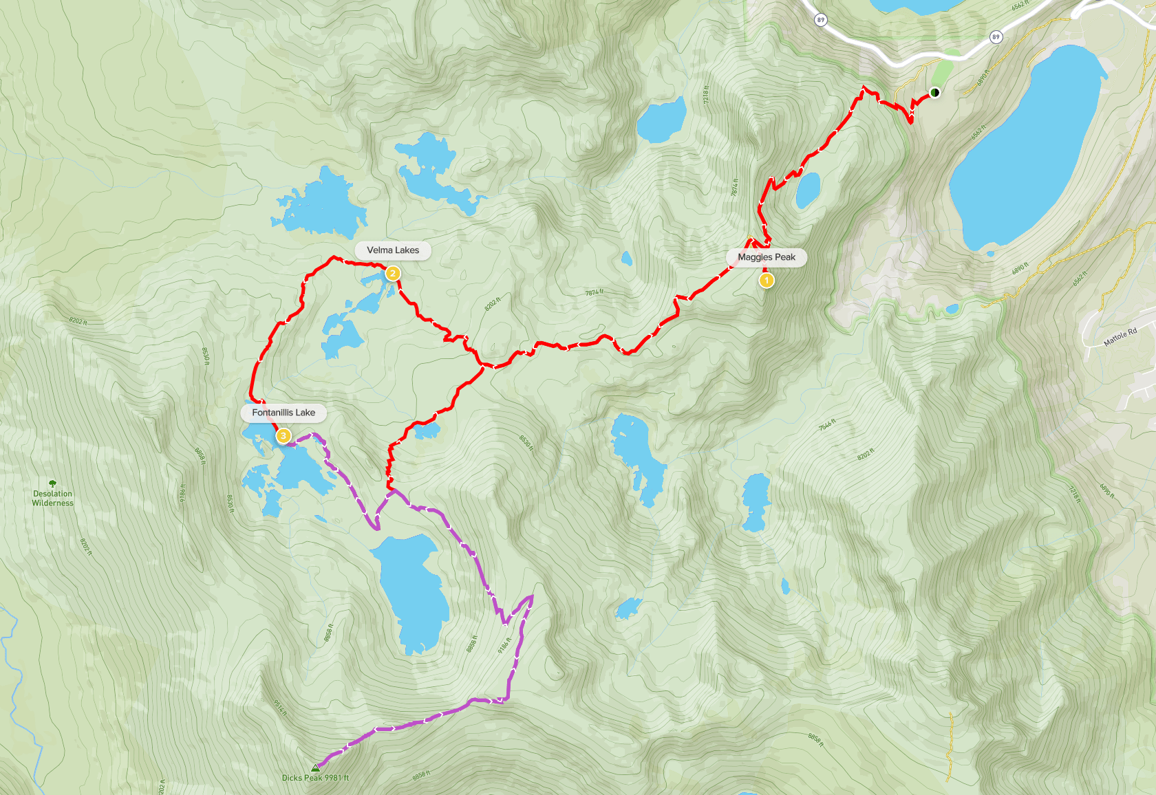
Bayview campground to Fontanillis Lake + Dicks Peak side trip (view in AllTrails)
Trip Overview
Desolation Wilderness is the wilderness area just southwest of Lake Tahoe. Its proximity to South Lake Tahoe and the Bay Area make it a great destination for a weekend trip. Within 6 miles of the trailhead, you will have access to the 3 Velma Lakes, Fontanillis Lake, and Dicks Lake, all of which have lakeside camping.
Our route began at Bayview Campground, right across the street from Inspiration Point and Emerald Bay. We stopped at Maggie’s Peak on the way to Fontanillis Lake, which is a short but steep detour to a viewpoint of Lake Tahoe. About 3.7 miles in, we took the right fork of the trail to Velma Lakes and then continued on to Fontanillis Lake where we camped the first night.
Because of the low mileage for this trip, we decided to spice up our otherwise very vanilla out-and-back route with a scramble up Dicks Peak the second morning.
Day 1: Fontanillis Lake
We went over Labor Day weekend but we only had a 2 day itinerary planned, so we decided to start our backpacking trip on Sunday and not leave the Bay Area until Saturday (we usually leave for Friday night right after work and don’t arrive until late at night, which is exhausting). All of us live in South Bay except for one friend who lives in SF. He took the BART across the bridge to meet us at Lake Merritt station, which is conveniently located near a Vietnamese sandwich shop that has now become our obligatory pre-trip staple: Banh Mi Ba Le (I have to shout out their special combo and meatball and egg sandwiches.) With a heavy bag of banh mis in our hands, we were ready for our road trip. The drive took around 3.5 hours and we arrived in the early afternoon. The rest of the afternoon we rented stand up paddleboards and went to Pope Beach to try stand up paddleboarding for the first time.
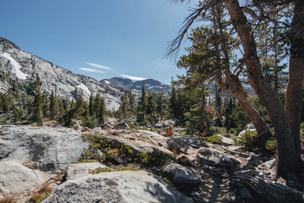
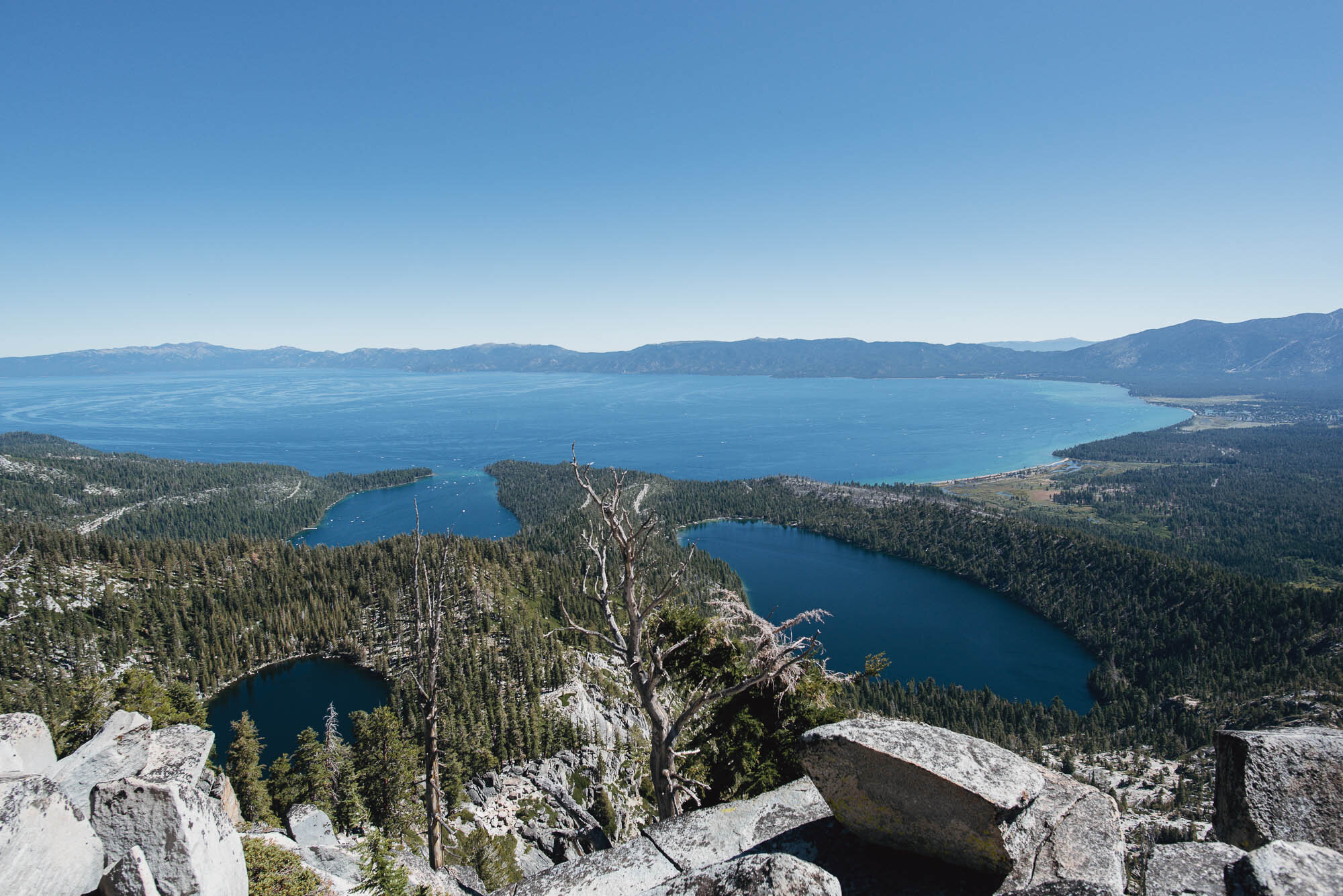
We were at the trailhead at 7:30 AM since we wanted to avoid hiking in the afternoon sun. The first part of the hike was shaded but gained elevation quickly. Shortly after passing Granite Lake, we climbed to a nice clearing with views of Emerald Bay. I had been coming to Lake Tahoe ever since I was a kid and had seen Emerald Bay dozens of times, but this was my first time hiking in the area—it was familiar yet exciting to see.

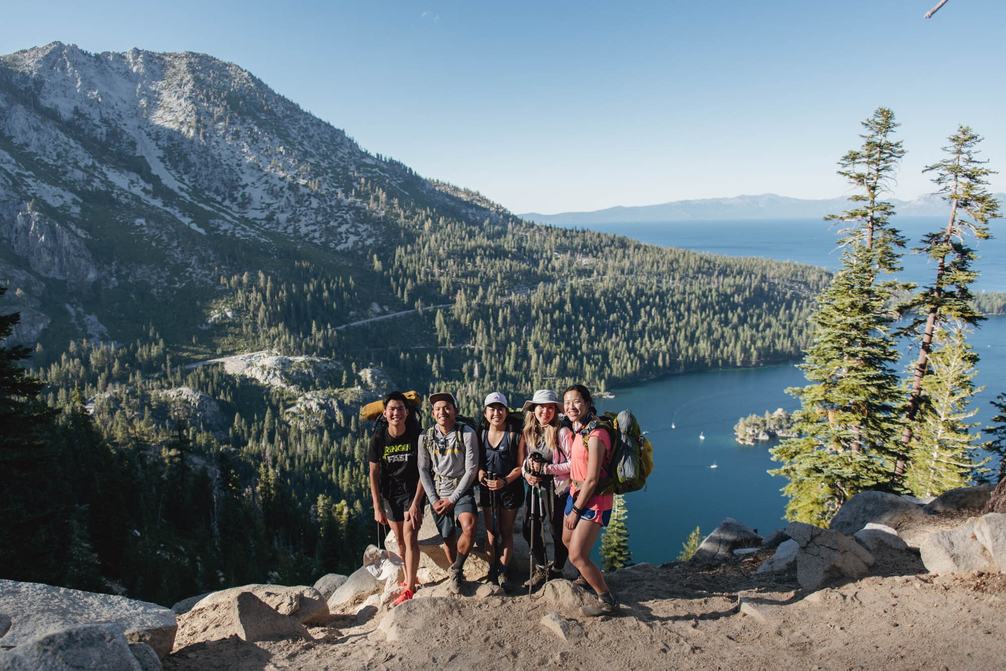
Pre-backpacking group photo

Bayview Trail giving us some nice bay views
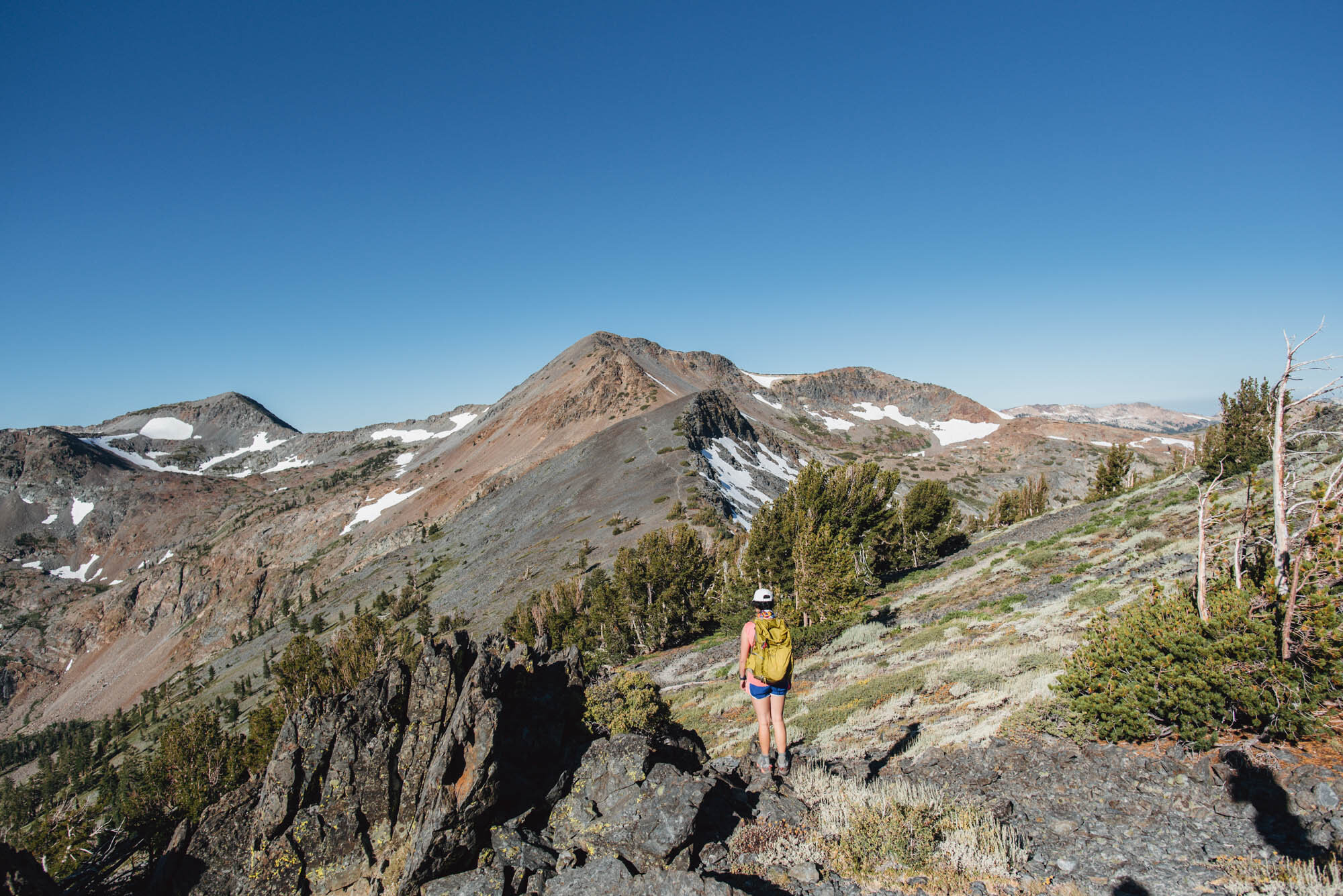
About 1.7 miles in, the trail reached the saddle between North and South Maggie Peak. From there, we followed an unmarked spur trail up South Maggie Peak. The ground was loosely packed and dusty, and there wasn’t really a clear trail to follow, but after a short 0.2 miles we were at the top. The views of Tahoe were unobstructed and stunning.
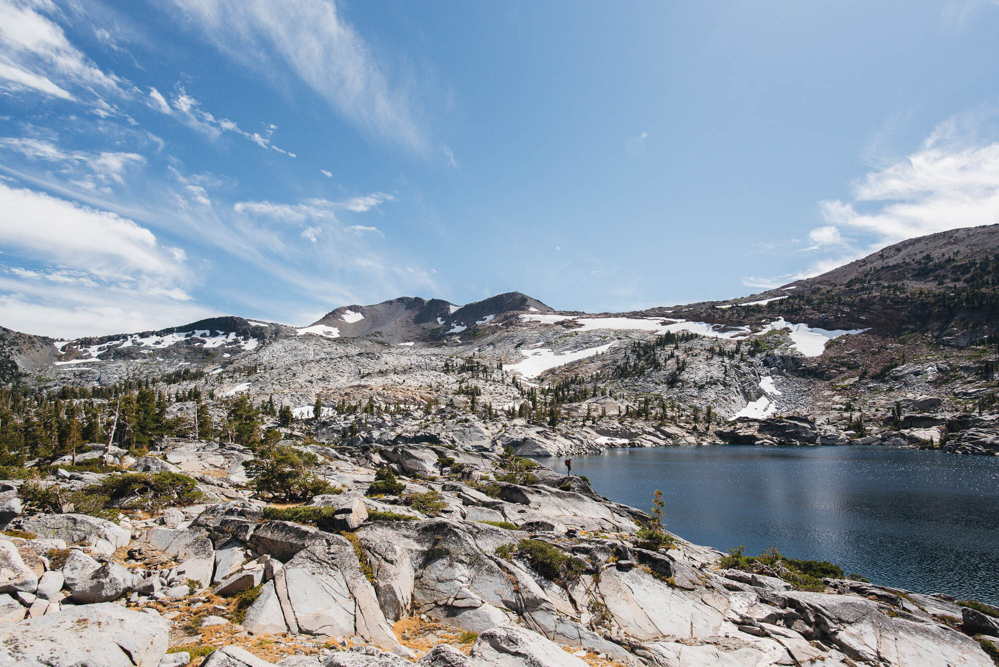
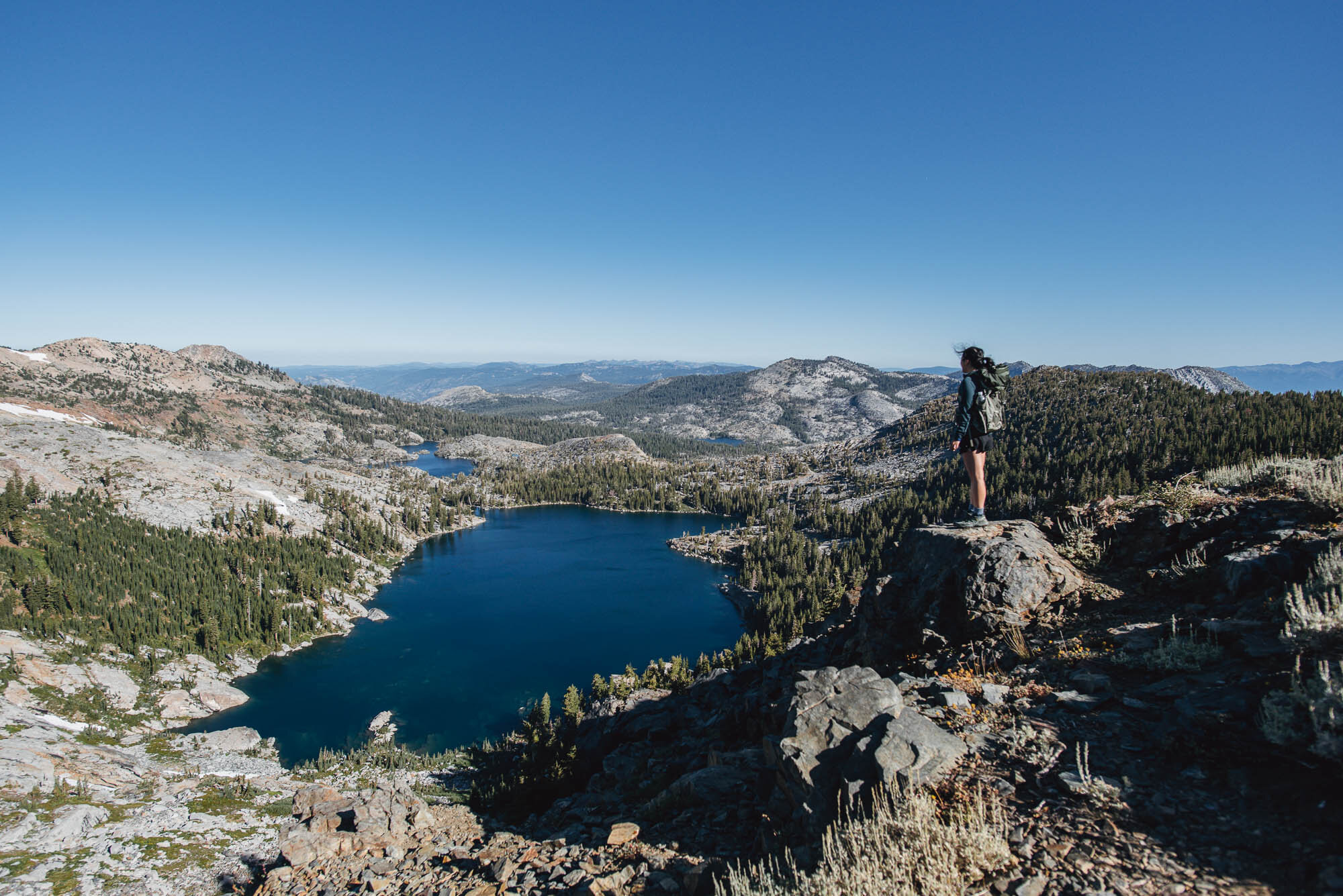
After the saddle, most of the elevation gain was done and the trail crossed into a granite basin. It was a mellow descent from there to Velma Lakes. We caught a glimpse of Upper Velma Lake from the trail, but the rest of the Velmas were farther from the trail and we were too lazy to explore. The trail junction with the PCT is soon after, and we headed southbound for about a mile after which we reached Fontanillis Lake.

View from South Maggies Peak

Views of the granite basin after Maggies Peak

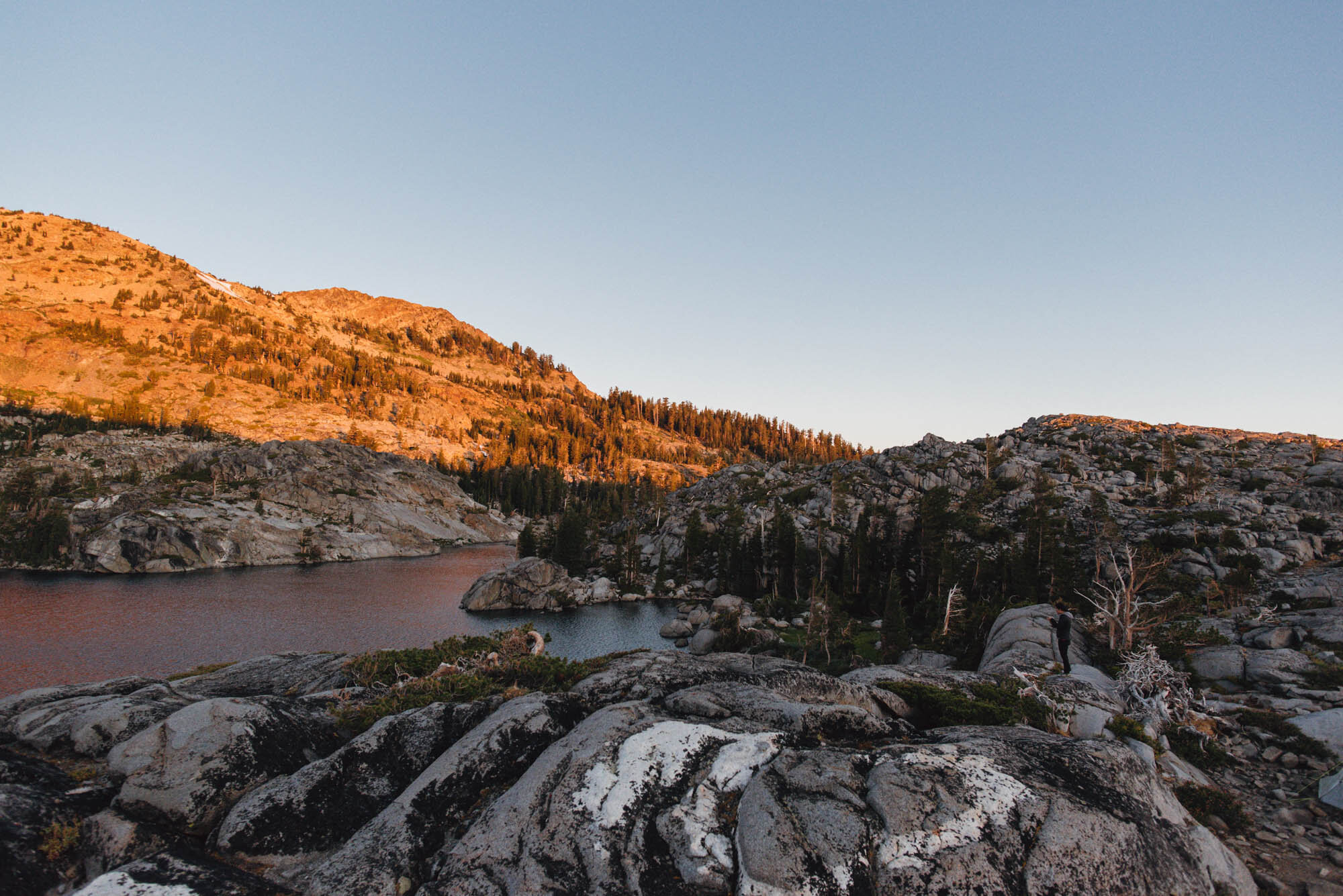
Arriving at the northern tip of Fontanillis Lake
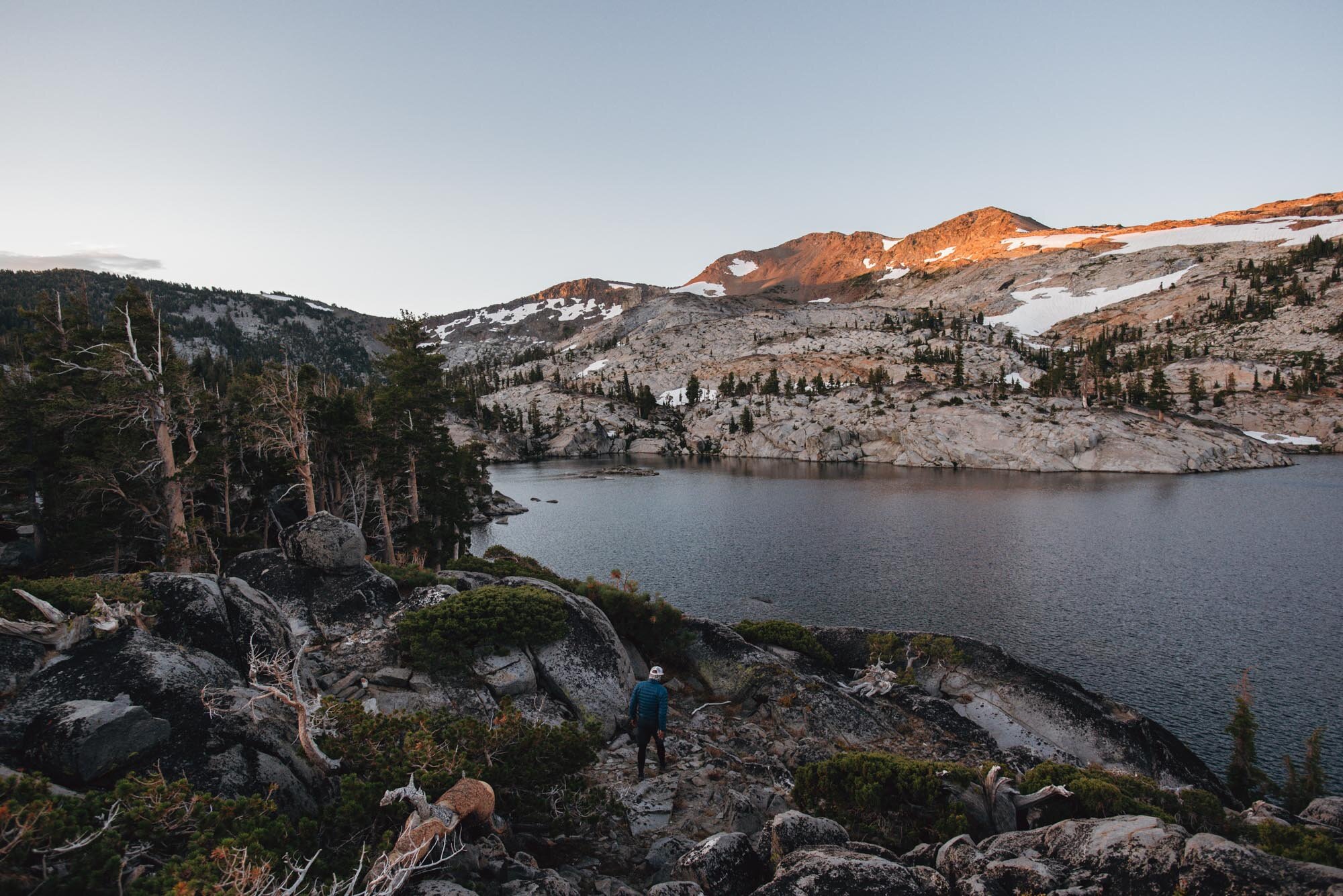
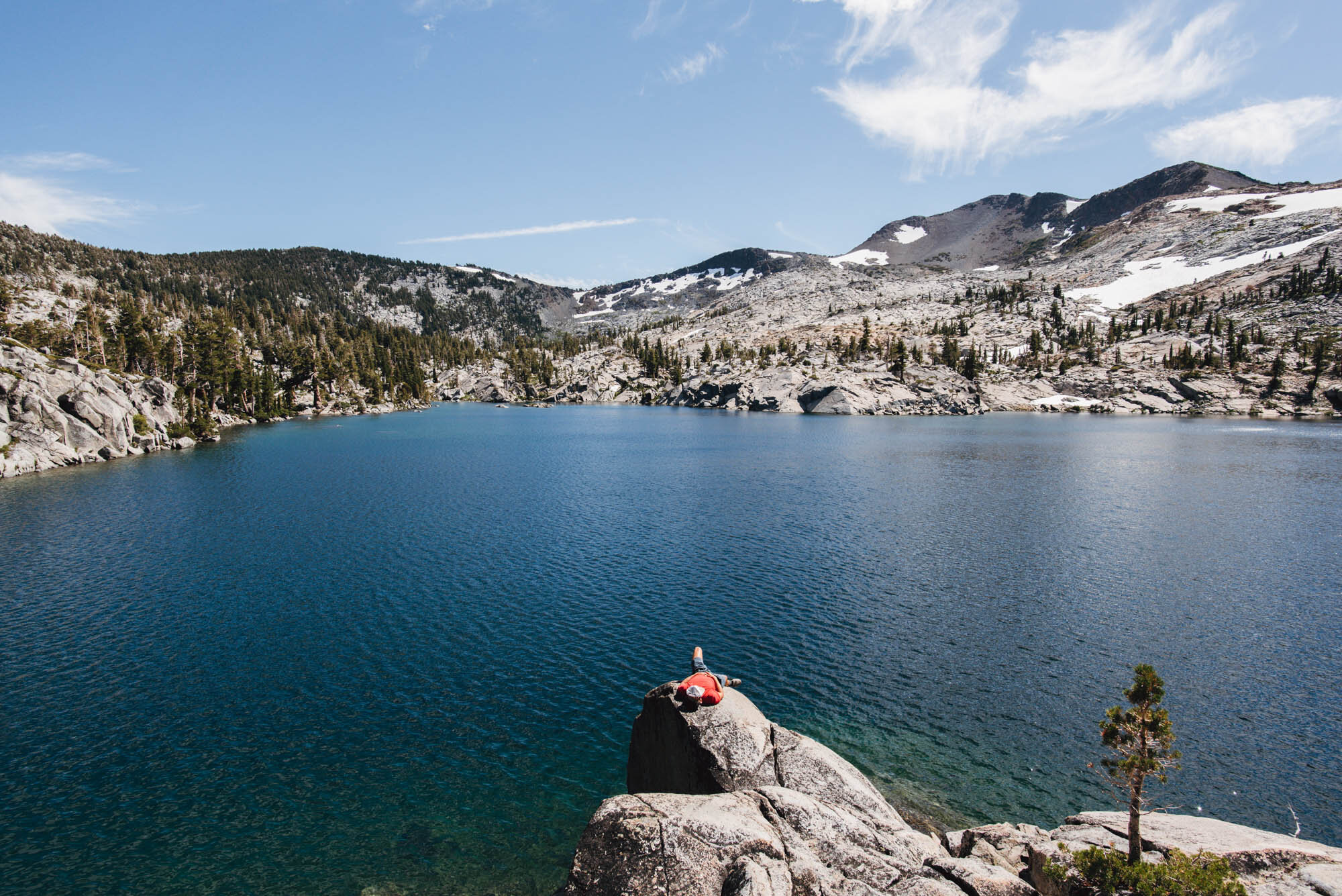
Fontanillis Lake was super clear and the water shimmered under the midday sun. Dicks Peak rose up distinctly on the western side of the lake, and the mountain was decorated with large white patches of snow.
The sandy trail followed the shore of the lake at first but turned away after the shore became lined with tall boulders about half a mile in. We wanted campsites with easy lake access but also good views, and we managed to find some cleared sites amidst the boulders overlooking the eastern shore of the lake.
From our campsites, it was a short steep walk down to the lake to our own little cove, where we spent the rest of the afternoon sunbathing, trying to swim in the too cold water, and putting an inflatable sleeping pad to the test as a raft.
We climbed up on a large rock to eat our lunch before setting out to find a camp spot

Searching for suitable campsites in this field of large boulders

Lake access from our campsite

Relaxing by the lake

Inflatable sleeping pads make just barely passable rafts
Day 2: Dicks Peak
We woke up at 5:30 AM to catch the beautiful sight of the first rays of sun hitting the western peaks. It was a pretty sleepless night for most of us because it was ridiculously windy. It wasn’t cold, but our tents whipped around loudly and relentlessly the whole night. (Also surprisingly, I wasn’t able to get any good Milky Way shots—I don’t think the skies were dark or clear enough.)

Dicks Peak glowing orange in the sunrise light

Our campsite! Enough space for our 4 tents
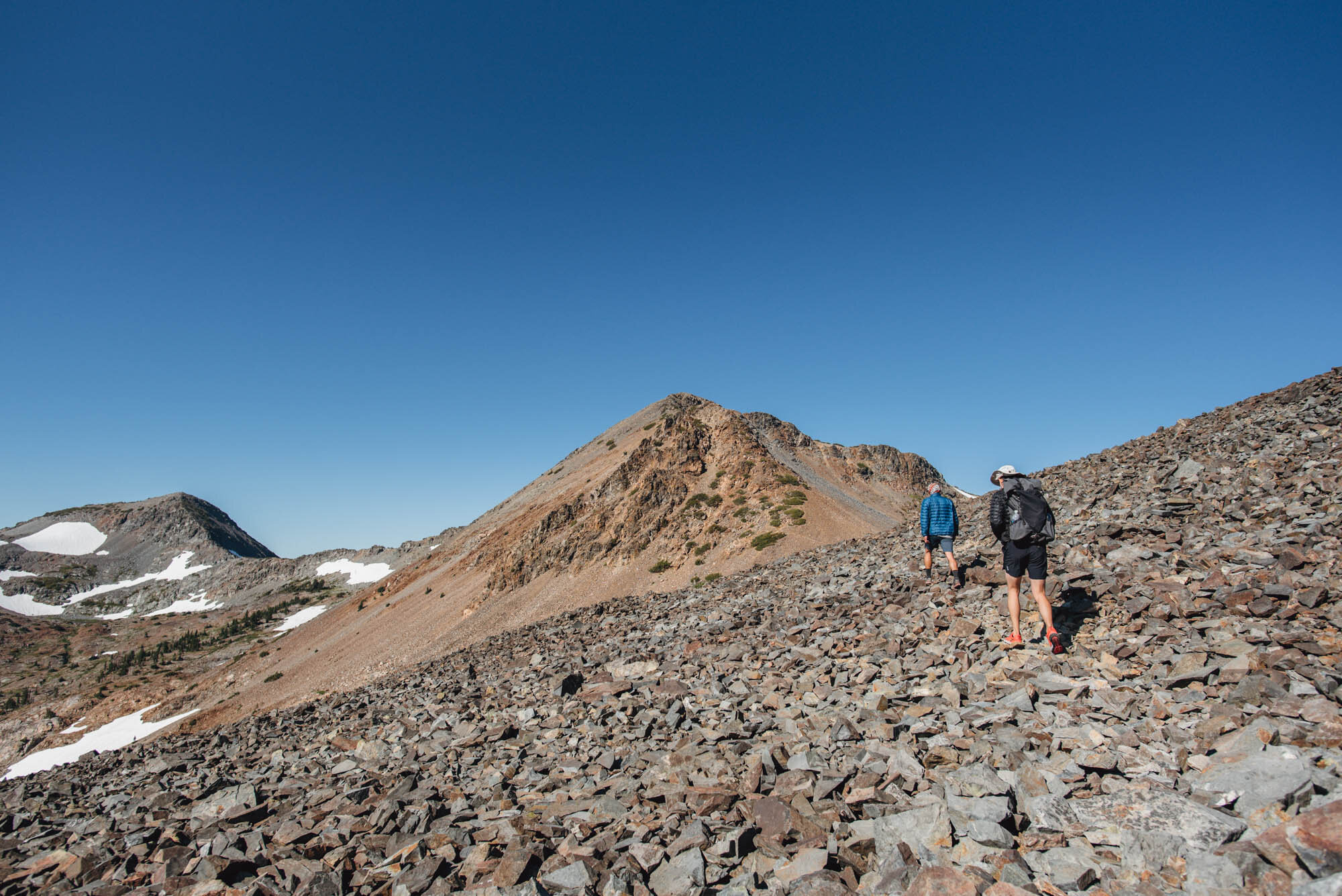
There are a few approaches for Dicks Peak. The approach we took was longer but mostly on trail. We followed the PCT southbound until we reached a sign marking Dicks Pass at 9,400 ft. There was a large patch of unmelted snow and great views over both sides of the pass.
The trail then descended slightly to a saddle where the PCT continued south down the other side of the ridge towards Half Moon Lake. We left the PCT at this point and stayed on top of the northeast ridge of Dicks Peak. After picking our way across a talus field, we arrived at a second saddle at around 9,400 ft where the scramble began.
The alternative approach is much shorter but requires cross-country travel after leaving Dicks Lake. You would cross the outlet of Dicks Lake and stay in the low point of the gully, either aiming for a saddle on the northwest ridge or the northeast ridge. It might be helpful to reference the GPS tracks on Peakbagger.
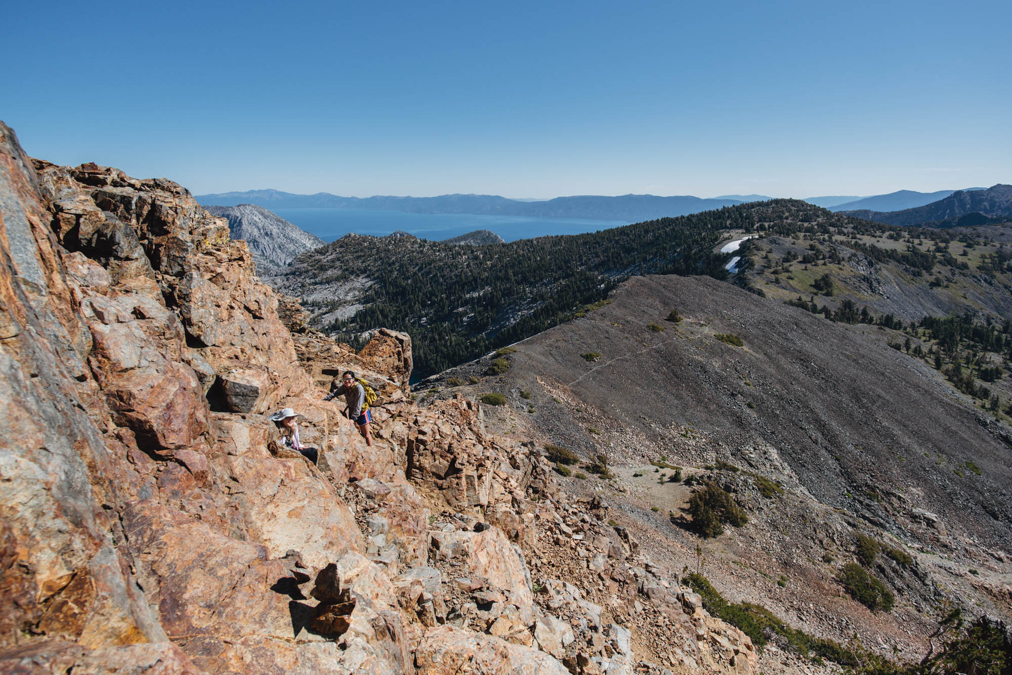
The scramble from the northeast ridge has a few class 3 moves in the initial section. My understanding of climbing classes is as follows: Class 1 is defined as hiking, which is the extent of what I’d done so far before this trip. Class 2 scrambling might require your hands to help with balance. Class 3 scrambling requires using your hands to climb and often has moderate to significant exposure, but there are plenty of hand and foot holds. Class 4 and 5 is usually out of the scope of scrambling and more in the realm of technical climbing (it’s why climbing grades are in the format 5.xx!).
Having just gotten into climbing a few months prior, I found scrambling super fun. The rock has to be good though, which is often not the case out in the wilderness. When the rock is crumbly and unstable, scrambling is more sketchy than fun. The hardest part of the Dicks Peak scramble was probably route-finding and trying to not dislodge too much scree and dust on the person behind us. The periodical cairns that we spotted were also unhelpful, but my friend scouted ahead of us so we didn’t have to backtrack too much.
We ended up stopping around 300 vertical feet short of the summit since it was all loose rock and we were over it; the views were good enough for us.

Dicks Lake


Right before the sign for Dicks Pass, the trail reaches a wide and flat area. The northeast ridge of Dicks Peak is visible in the center of the photo.

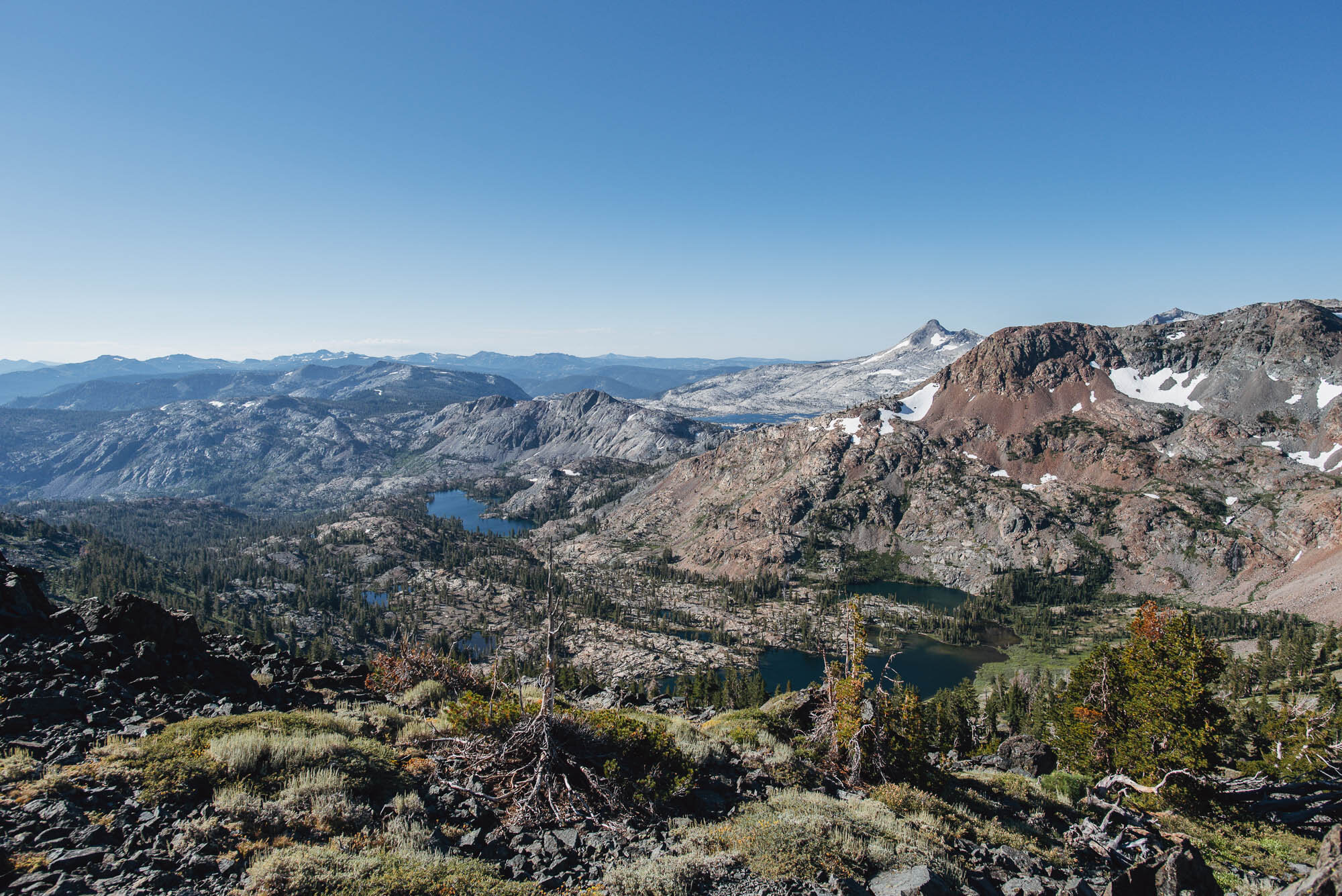
From the ridge, we could see Half Moon Lake, Susie Lake, and the gray-white Aloha Lake basin in the distance
A faint trail leads over the talus field
Looking out over Dicks Lake and Fontanillis Lake in the back
Almost at the base of the scramble, the fun part

There are a few class 3 moves around this part of the scramble
The deep blue Lake Tahoe is expansive

Taking a break on top of the ridge; Mt. Tallac is the dark and pointy peak visible on the right of the photo

Looking down the north face. It’s a scree-filled slip and slide but a much shorter descent. Pick your torture!
This was the first time we planned a scramble into a trip, and it was an eye-opening addition to our backpacking repertoire. Scrambling and peak-bagging are challenging and exciting, and the views at the end are the ultimate reward. Now, when I trip plan, I look at the map of our backpacking route and search the names of nearby peaks. I study the topography to see if there are cross-country shortcuts to optimize our route and connect more points of interest. Most of the time, there will already be routes described on other blogs, Peakbagger, SummitPost, and High Sierra Topix. I see cross-country travel as a gateway to more remote landscapes and more thrilling adventure, and it’s definitely something I hope to dive into in the future.
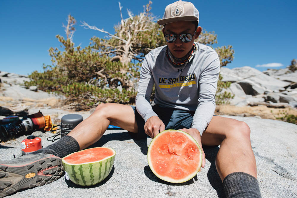
Back at our campsite and cutting open a celebratory watermelon