Fall Colors in the Eastern Sierra: Dusy Basin via Bishop Pass
Trip at a Glance
| Distance | 15 miles |
| Elevation Gain | 3,000 feet |
| Elevation Range | 9,829 - 11,972 feet |
| Length | 2 days |
| Permit | Bishop Pass - South Lake (Inyo National Forest) |
| Highlights | South Lake, Long Lake, Saddlerock Lake, Bishop Lake, Bishop Pass, Dusy Basin, Lake 11,393 |
| Type | Out-and-back |
| Date of Report | October 8 - 9, 2022 |
The Route
| Day | Destination | Miles | Gain | Loss | 1 | South Lake to Dusy Basin | 7.5 | 2400' | 600' |
|---|---|---|---|---|
| 2 | Dusy Basin to South Lake | 7.5 | 600' | 2400' |
Trip Overview
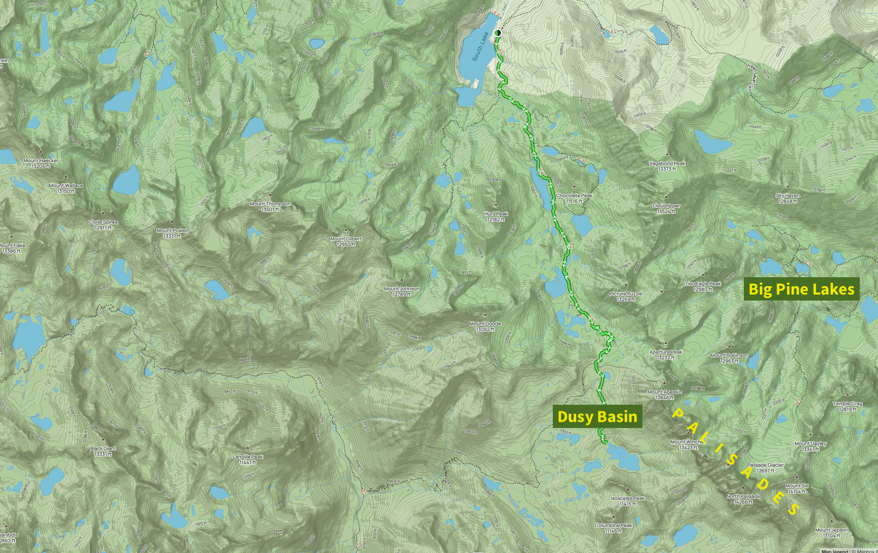
Dusy Basin contains several unnamed alpine lakes and is located on the remote, eastern side of Kings Canyon National Park. The trail begins outside the park at South Lake in the John Muir Wilderness and crosses into Kings Canyon National Park via Bishop Pass, the highest point of the trip at 11,972 feet. The trail is not particularly steep, but the altitude makes everything harder. After Bishop Pass, the trail descends around 600 feet into Dusy Basin.
Most of the Eastern Sierra is remote and rugged. Numerous alpine lakes dot the region—so many that some are unnamed, referred to only by their elevation. The terrain is completely above treeline, so the views extend as far as your eyes can see. The mountains are strikingly jagged, and there are dozens of iconic peaks here that are on the lists of many peakbaggers. This straightforward out-and-back trip is a great introduction to the scenery of the Eastern Sierra.
Day 0: Driving to Mammoth Lakes

Views of the Sierra from Wild Willy’s Hot Springs
The only reason I've done so few trips in the Eastern Sierra is because getting there from the Bay Area is a chore. It's 6+ hours of driving since you need to drive across the Sierra Nevada (usually via Tioga Pass on CA-120 through Yosemite), and then several more hours down the eastern side of the Sierra on US-395. We split the driving into 2 days: 5 hours to Mammoth on Friday, and another hour to the South Lake trailhead on Saturday morning.
Since we arrived with time to spare on Friday, we decided to check out Wild Willy's Hot Springs before sunset. The hot springs are naturally-formed, open-air pools 20 minutes from Mammoth Lake's downtown. Their backdrop is an expansive valley with views of mountains in every direction. The setting sun bathed everything in warm, golden light. It was a beautiful time to take a dip, but we weren't the only ones with that idea. We were joined by many other people, and by even more mosquitoes. The water temperature was perfect, but we didn’t stay too long and retreated back to our car covered in bites.
Day 1: South Lake to Dusy Basin
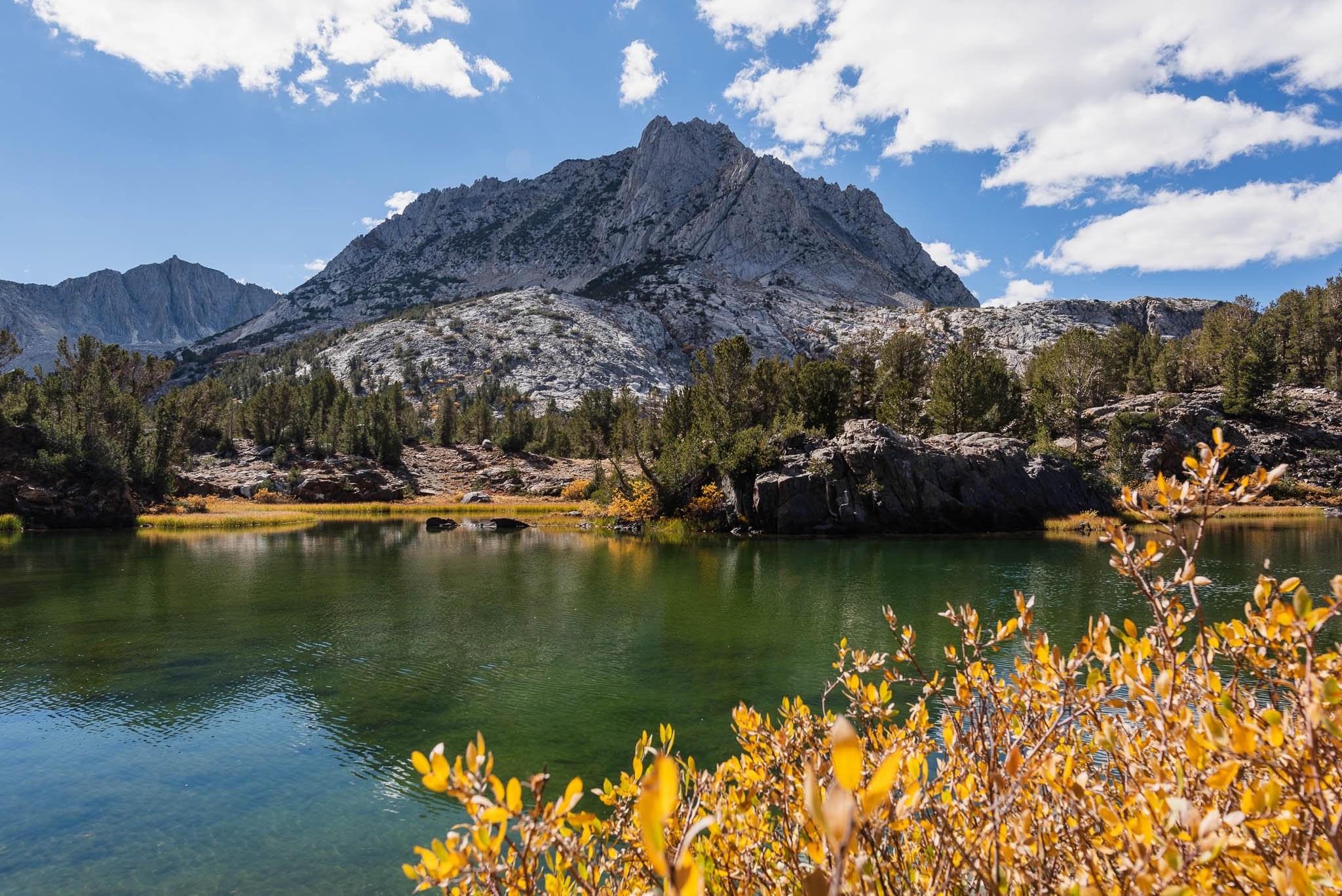
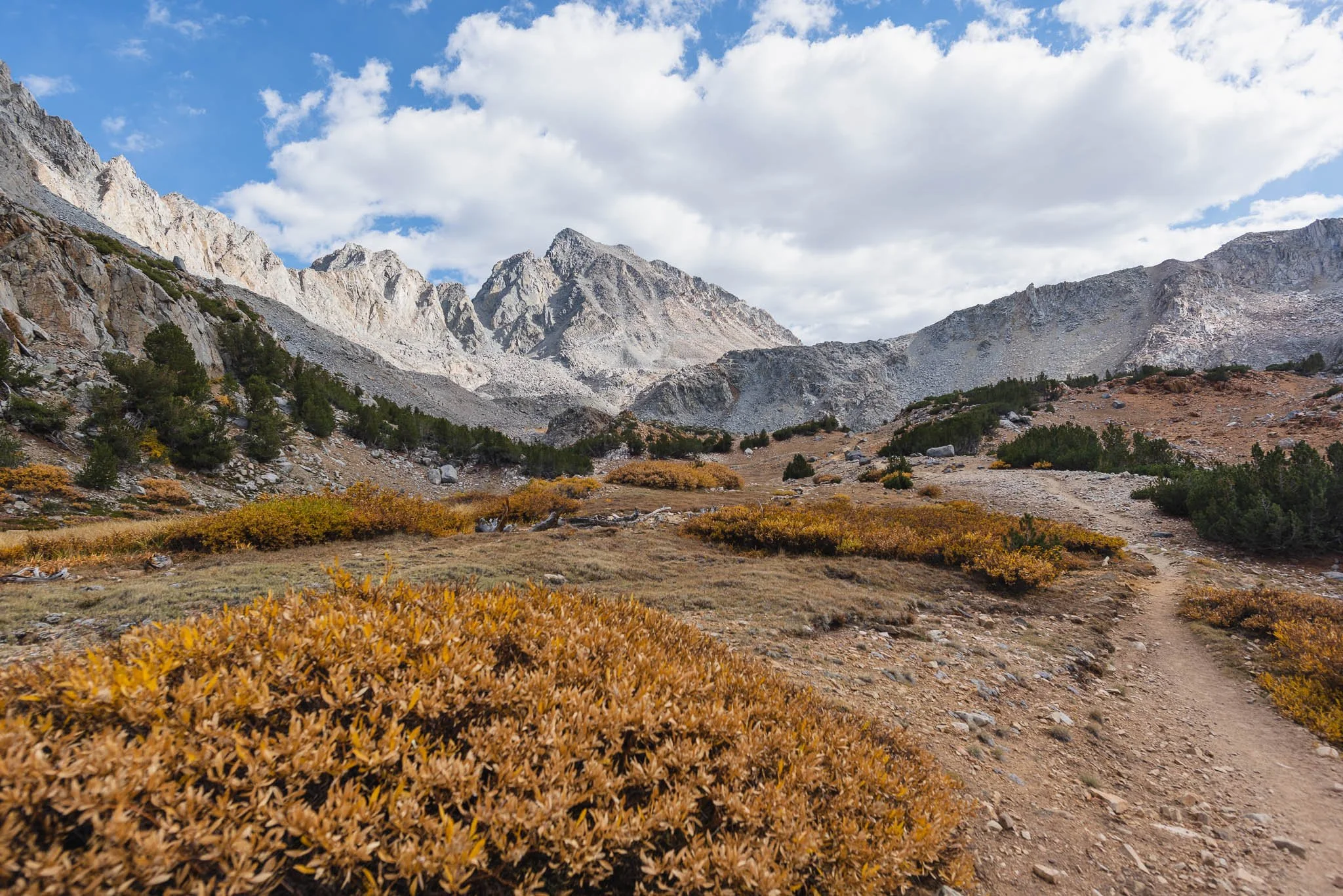
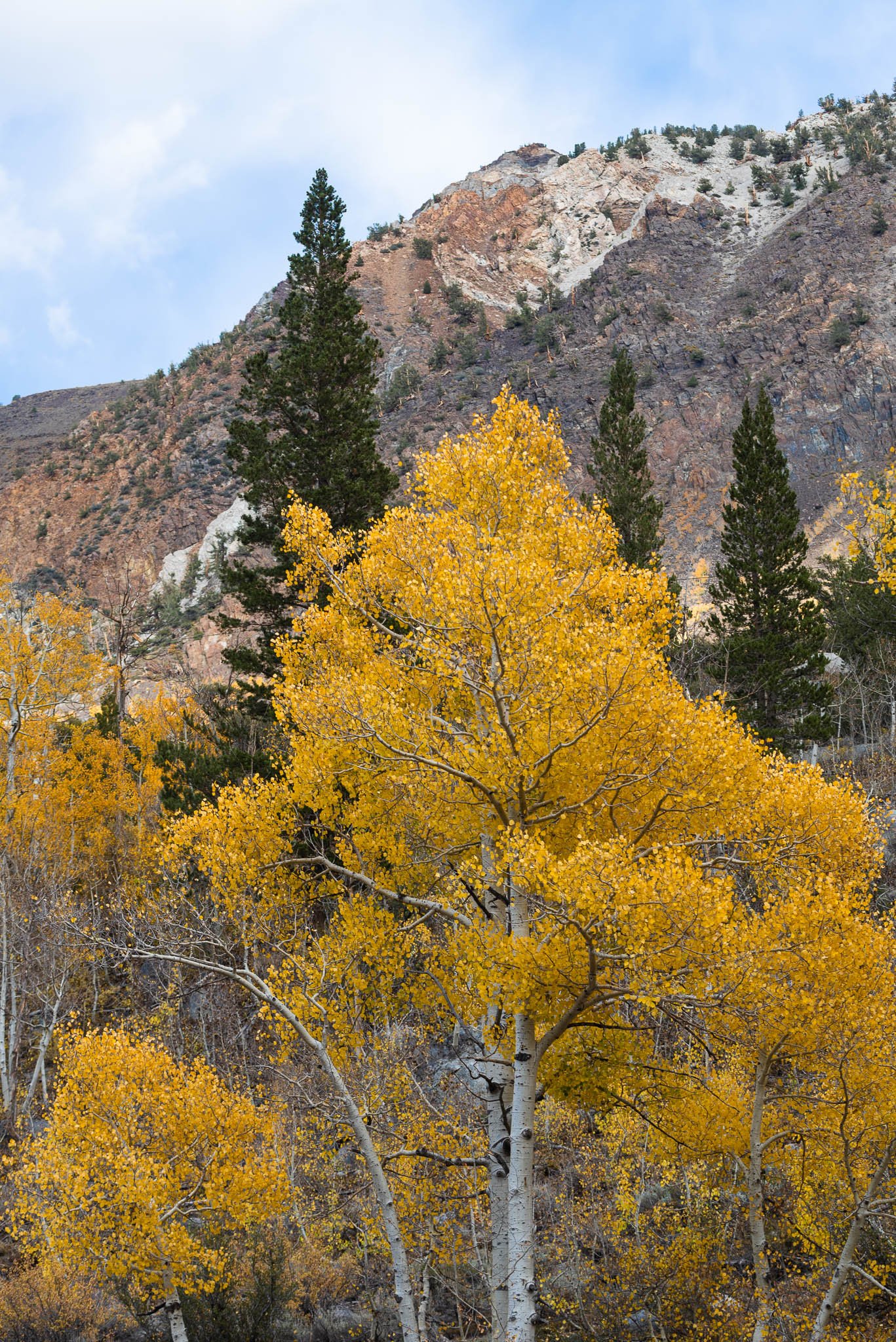
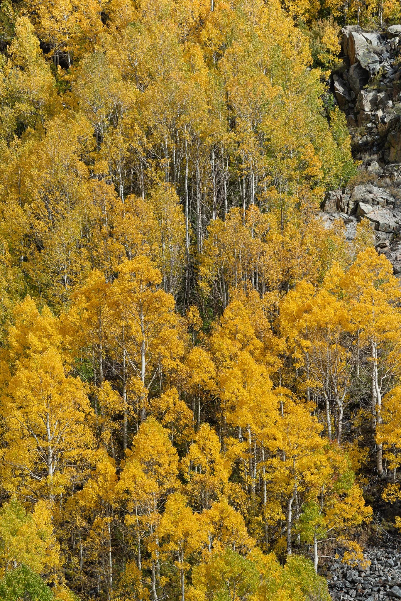
The drive from Mammoth Lakes to the trailhead at South Lake takes around an hour and 15 minutes. Aspen groves lined the road as we got closer to the trailhead. It was the peak of fall colors, and the dazzling yellow leaves fluttered in the light breeze.
The road up to South Lake was busy with day-hikers and campers. Even though the South Lake parking lot is sizable, day-hikers overflowed into the overnight parking spots. We had to wait for a car to leave before we could get a spot.
Fall is probably my favorite time to hike in the mountains. The weather is cooler, it's generally less busy, and the golden foliage makes the scenery even more painterly.

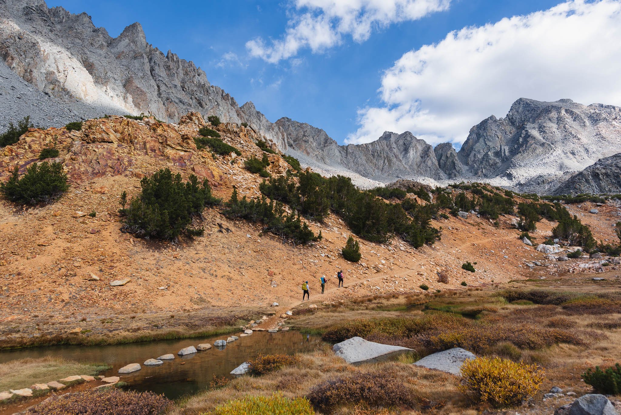
Whereas some trails might have just one lake as the final destination, we passed lake after lake in just the first 5 miles.

Bishop Lake, just off the Bishop Pass trail
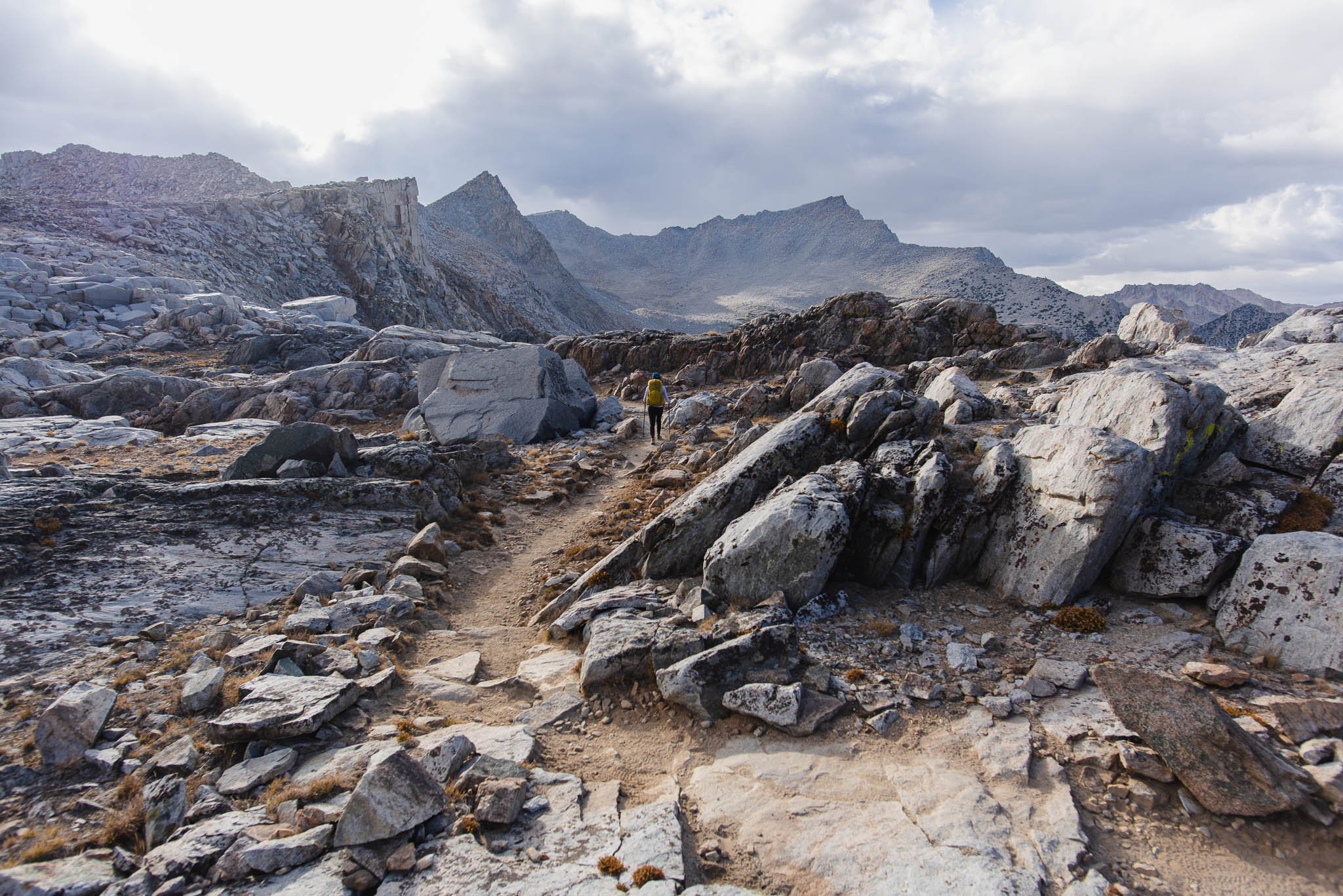
The trail is gently graded until Bishop Lake, the last lake before the ascent to Bishop Pass. The ascent to Bishop Pass is steep, but the rocky switchbacks are well-built. As we hiked higher and higher, the multiple lakes that we passed by earlier in the day came into view. Bishop Pass itself is wide and flat, so make sure to take photos of this side before continuing away from the views to the Bishop Pass sign. The sign at 11,972 feet marks the entry into Kings Canyon National Park.

Starting the steeper, rocky portion to Bishop Pass

I can’t see where the trail disappears to in this photo, but it’s not a scramble like it appears to be.


Views of where we came from as we neared Bishop Pass
There is something about high altitude scenery that really draws me in. The harsh environment, where few plants grow and towering granite reigns supreme, is beautiful in its bareness. The late afternoon sun and clouds cast dramatic shadows on the landscape. I felt like I was exploring a different planet.
Done with the elevation gain, and just steps from the Bishop Pass sign. The trail is surrounded by sizable rock slabs.

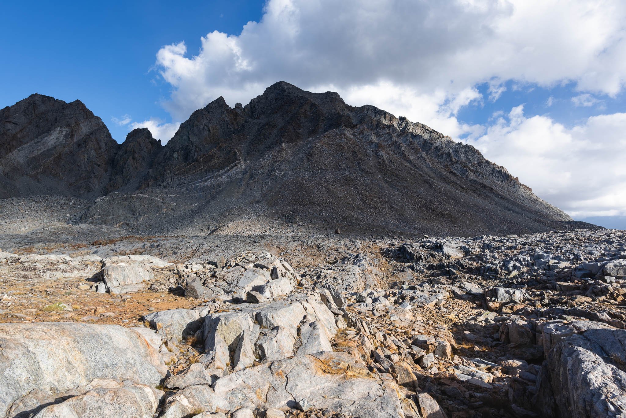
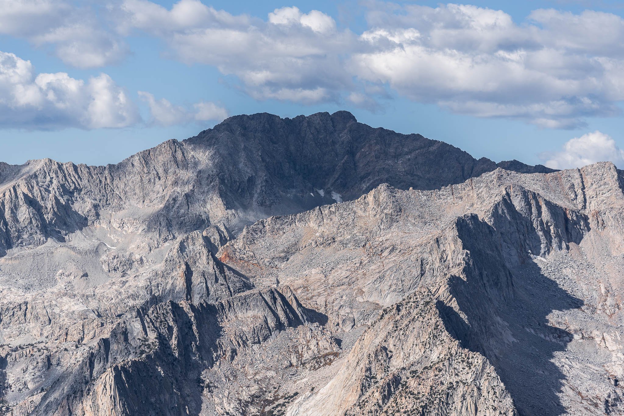
Mt. Agassiz. We met a few day-hikers who were on their way to peak bag this shadowy giant.

Mt. Agassiz again. Same time of day, different lighting.
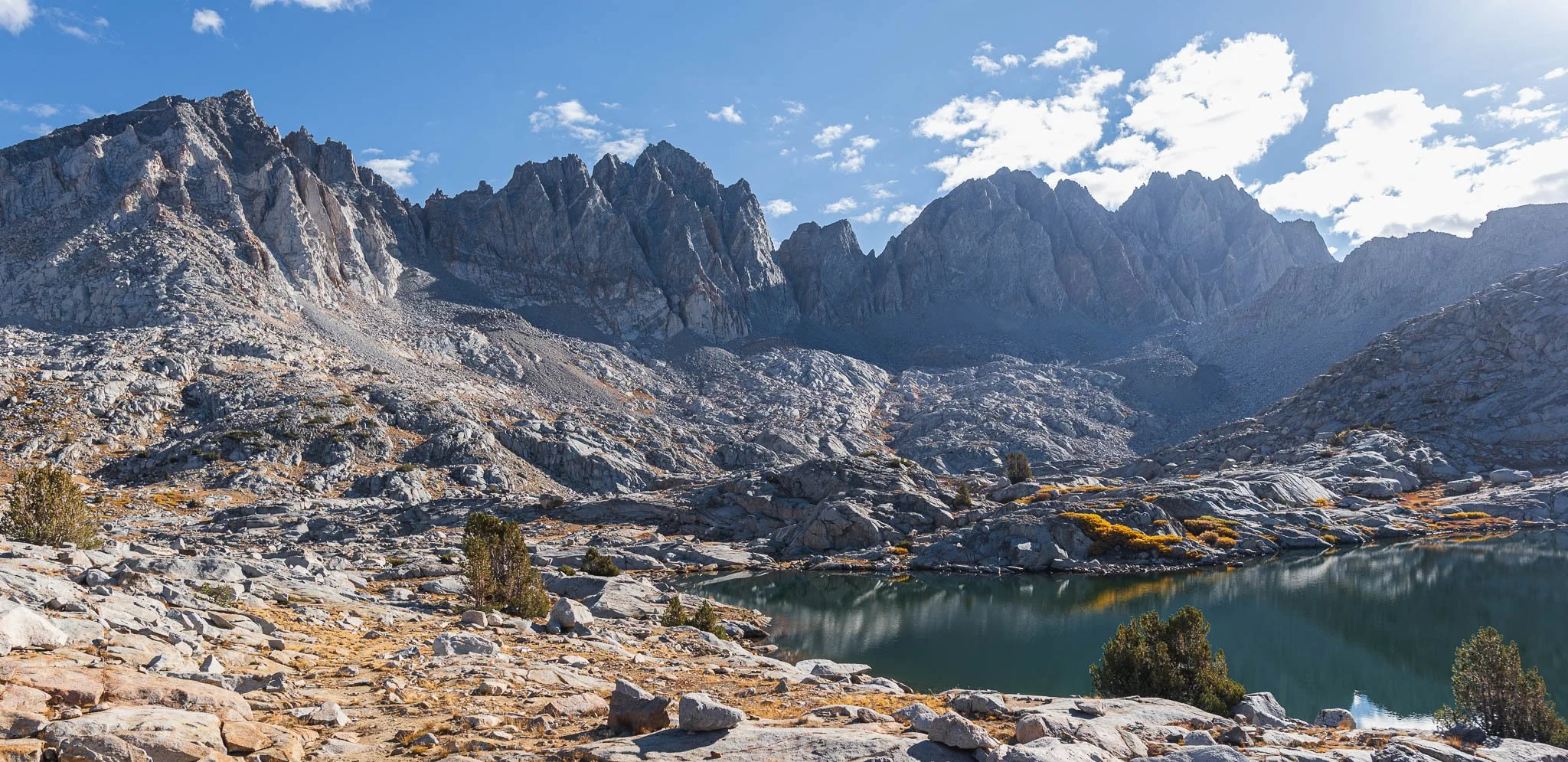
After the pass, we left the official trail and followed the approximate off-trail route on AllTrails. The off-trail route was more direct to where we wanted to camp at Lake 11,393. It was easy bushwhacking since there was no bush at all—just rock and shrubs.
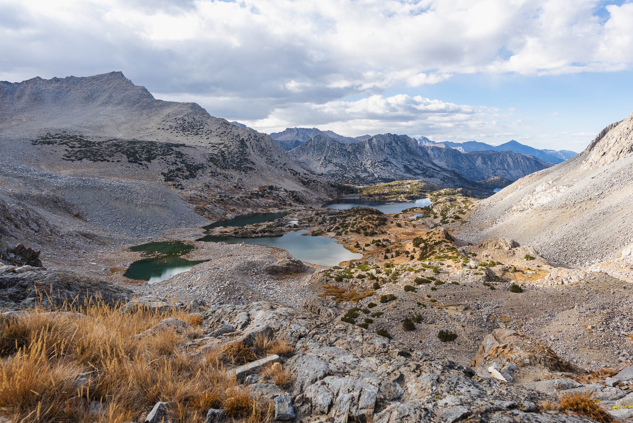
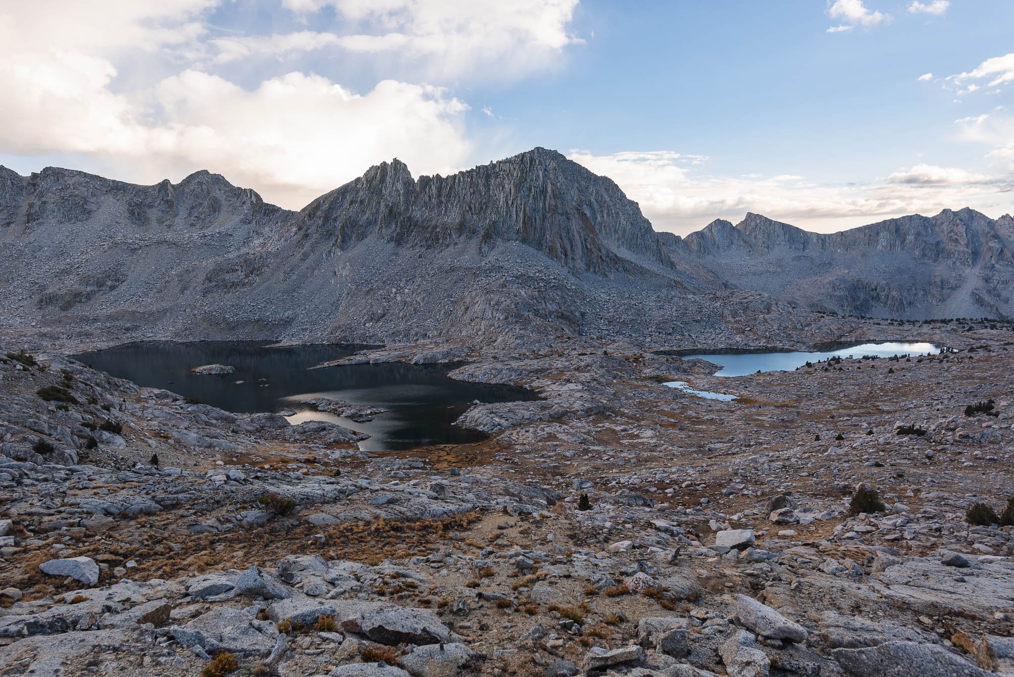
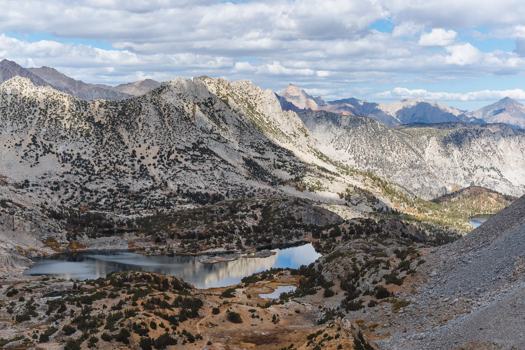
The view descending into Dusy Basin was spectacular. Lake 11,393 and the adjacent, larger Lake 11,427 were nestled at the foot of the wall of mountains in front of us. Centered between them was Isoceles Peak. Isoceles Peak looks less prominent from this angle, but as we approached the lakes, its triangular form became more defined. The splintered edges and cracked faces of the peak looked as if someone had taken a hammer to them and created the pile of loose rock that extended all the way down to the lake shore. Craggy, towering peaks surrounded us on all sides.

These fluffy rings of grass look like something out of Dr. Seuss.

Descending into Dusy Basin. We camped near the lake on the right, Lake 11,393.

Isoceles Peak
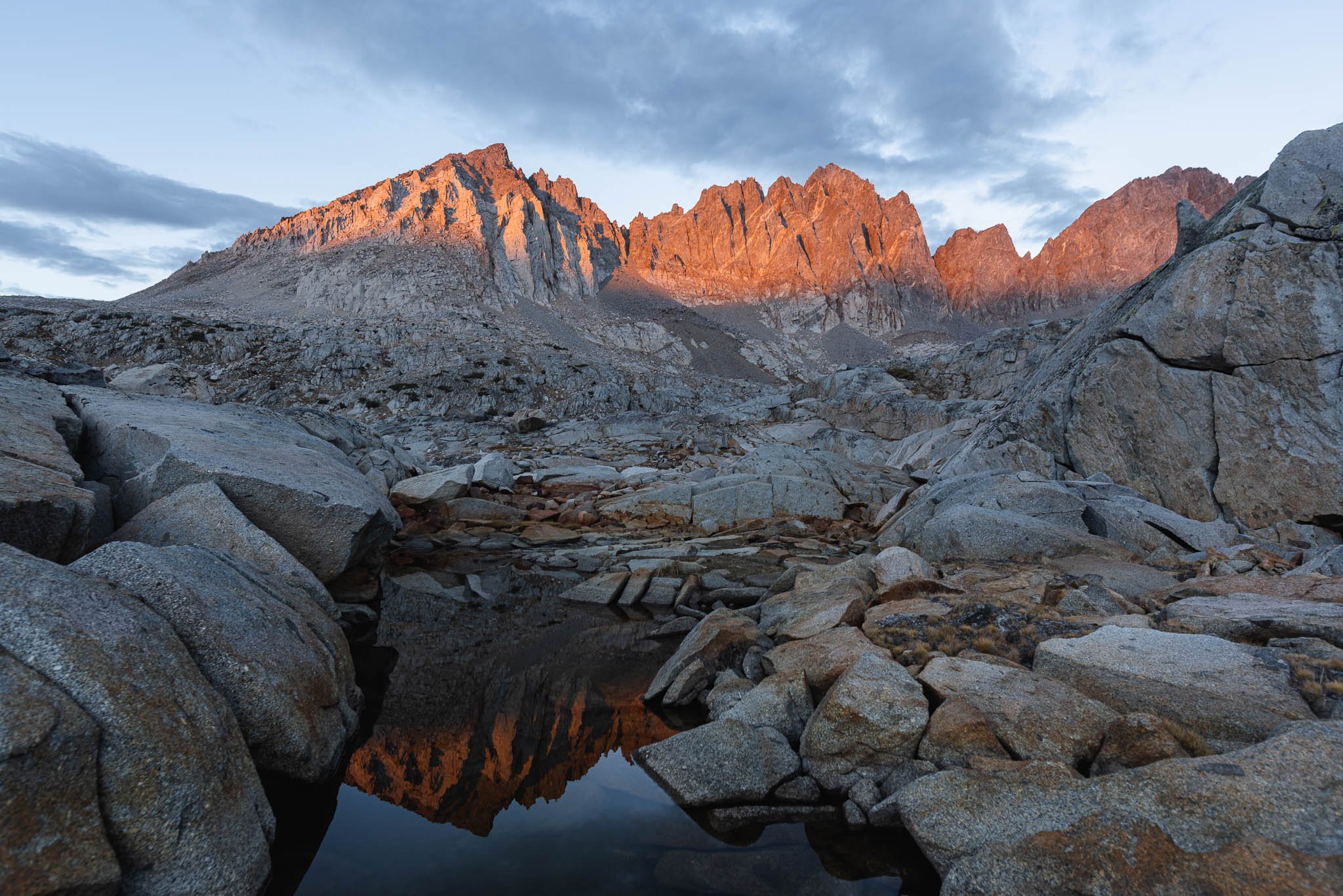
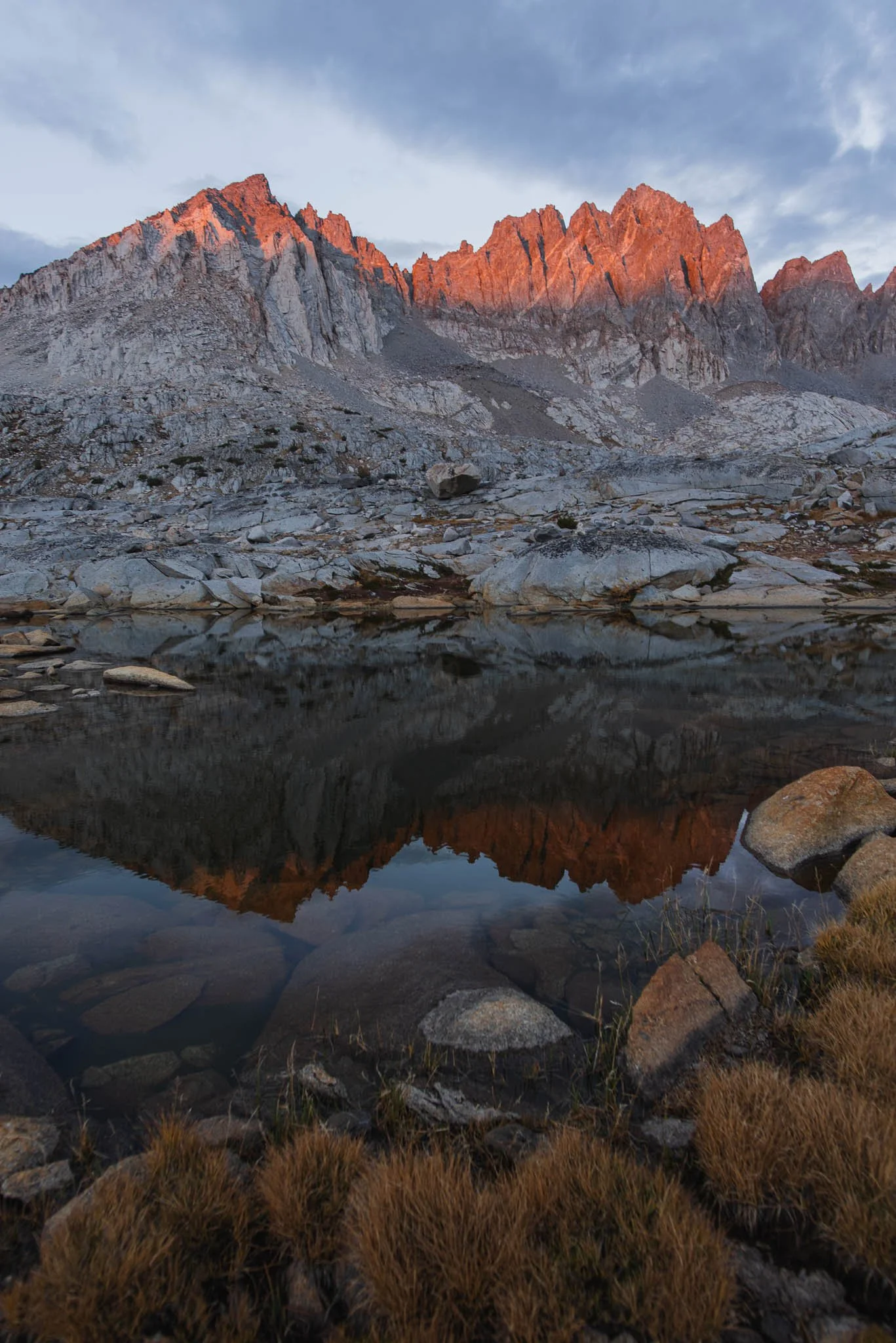
The setting sun was hidden behind clouds at the horizon. It was getting dark quickly. We scrambled to find a campsite and settled on the first obvious ones we found near the south end of the lake. Even as it seemed that the sun would set without event, the scarlet sun burst through a crack in the clouds and the peaks in the south glowed crimson. I raced around taking photos, breathless from the altitude and the beauty, searching for compositions in the puddles.

Alpine glow reflected in a small puddle
After the sunset excitement, I decided to take a nap in my tent before cooking because the altitude lightheadedness was getting unbearable. Twenty minutes after lying down, I felt my body against the cold ground through my sleeping pad. I inflated my sleeping pad again and wondered if that was somehow a fluke, but sure enough, my butt was touching the ground in another 20 minutes. My sleeping pad was definitely leaking. With the altitude wooziness and the sleeping pad-less night ahead of me, I could hardly get excited about the raw eggs I had brought to cook my elevated Shin ramen dinner.
This was one of those nights where I lie awake thinking to myself that I'm never backpacking again. I did end up falling asleep after a few hours of tossing and turning, but I woke up like clockwork every 40-45 minutes to my body on the ground. By the end of the night, I was falling back asleep in minutes after waking up to reinflate my sleeping pad.
Day 2: Dusy Basin to Trailhead
I woke up around 6 AM just as it was starting to get bright. The sky was perfectly clear, and the lake was a mirror in the windless morning. This sounds dramatic, but seeing the morning light felt like I had weathered a storm. When I was laying awake the night before, I was running through all the worst-case scenarios in my head: I'd freeze using a deflated sleeping pad; my altitude sickness would worsen; I'd lie awake for the whole night. But it was morning now, and I actually got sleep.
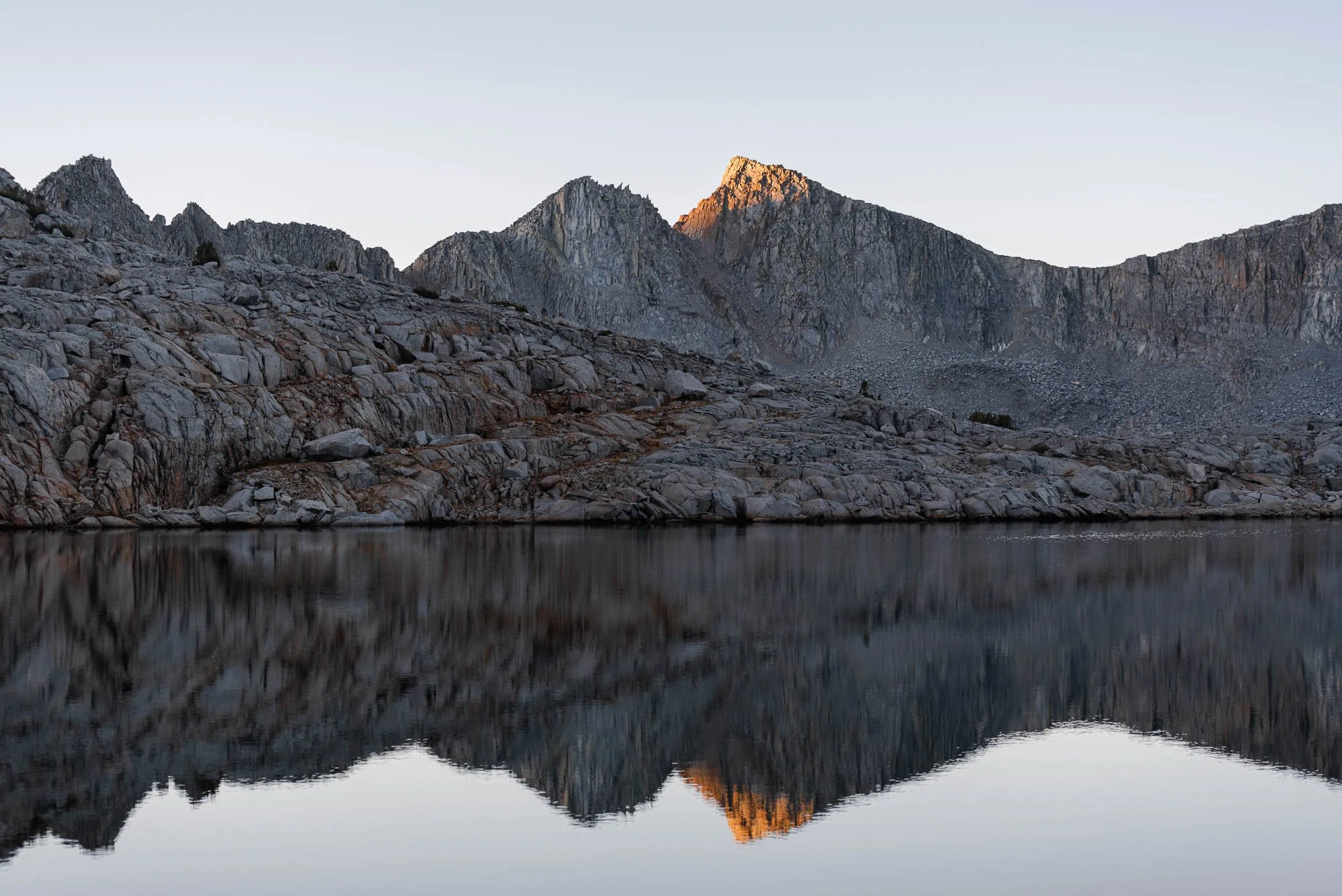

Isoceles Peak, backlit at sunrise
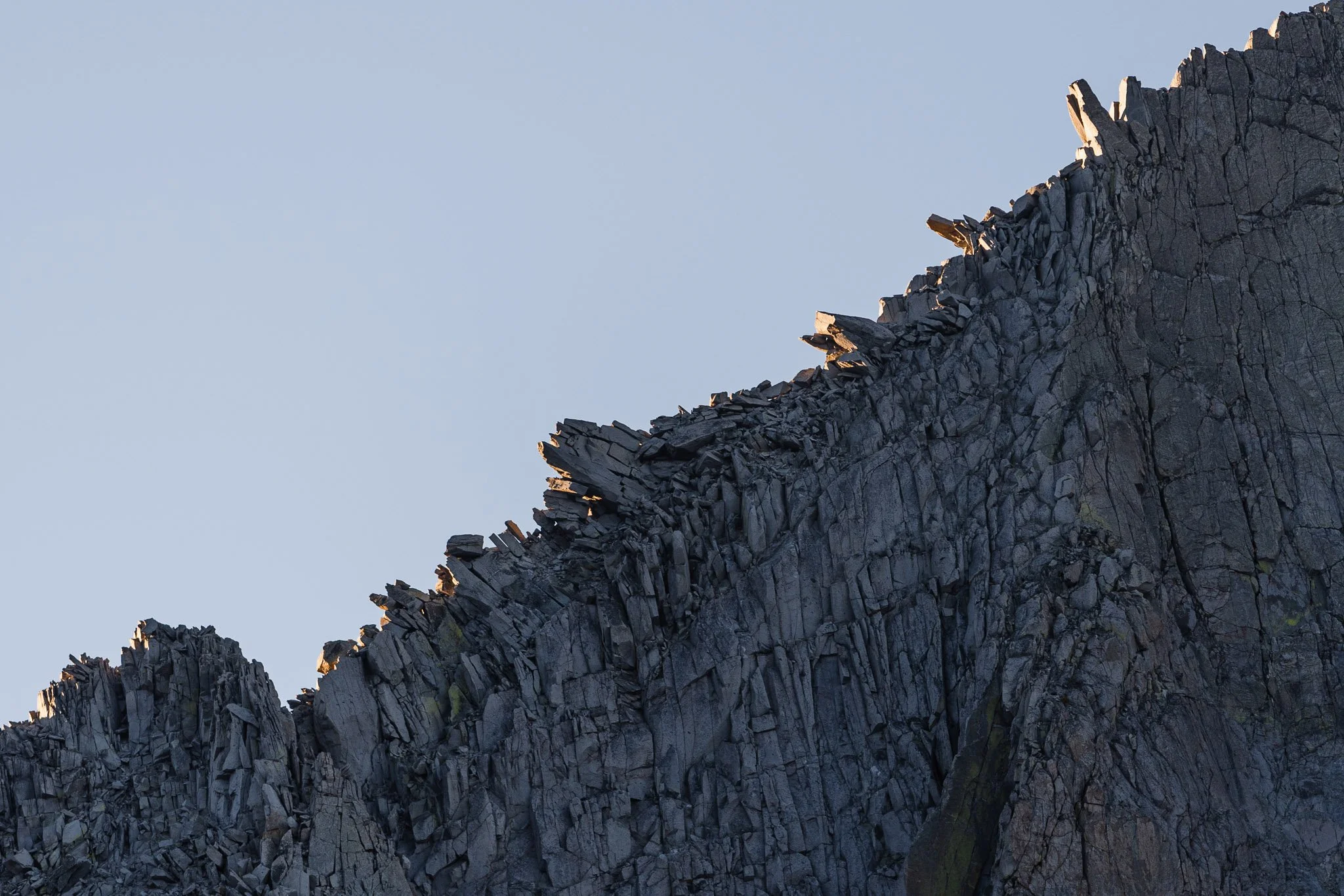
From a distance, the ridge looks so fragile as if the rocks are ready to flake off.
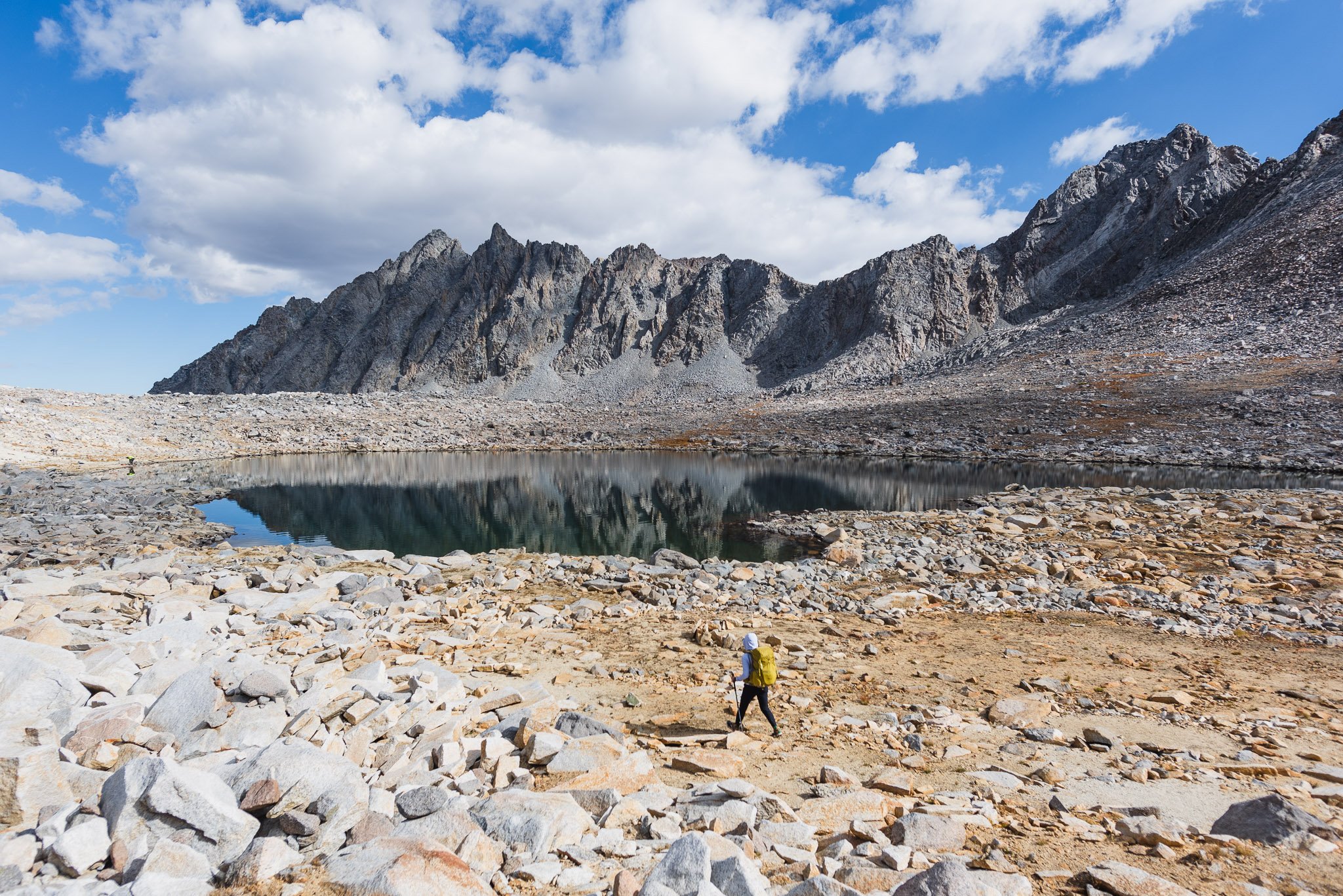
The sunlight crept across the peaks slowly and flooded the basin with warmth. We packed up camp and retraced our route back up to Bishop Pass, this time making sure to not miss the unnamed tarn at 11,923 feet.
Peaks in the distance

Approaching the tarn near Bishop Pass
Even though it was an out-and-back trip, it felt almost like I was doing a different trail from the day before. Hiking in the opposite direction made me see new compositions of lakes and peaks that I hadn't noticed. We were also facing towards the view instead of away from it, and got to take it in for the whole descent.
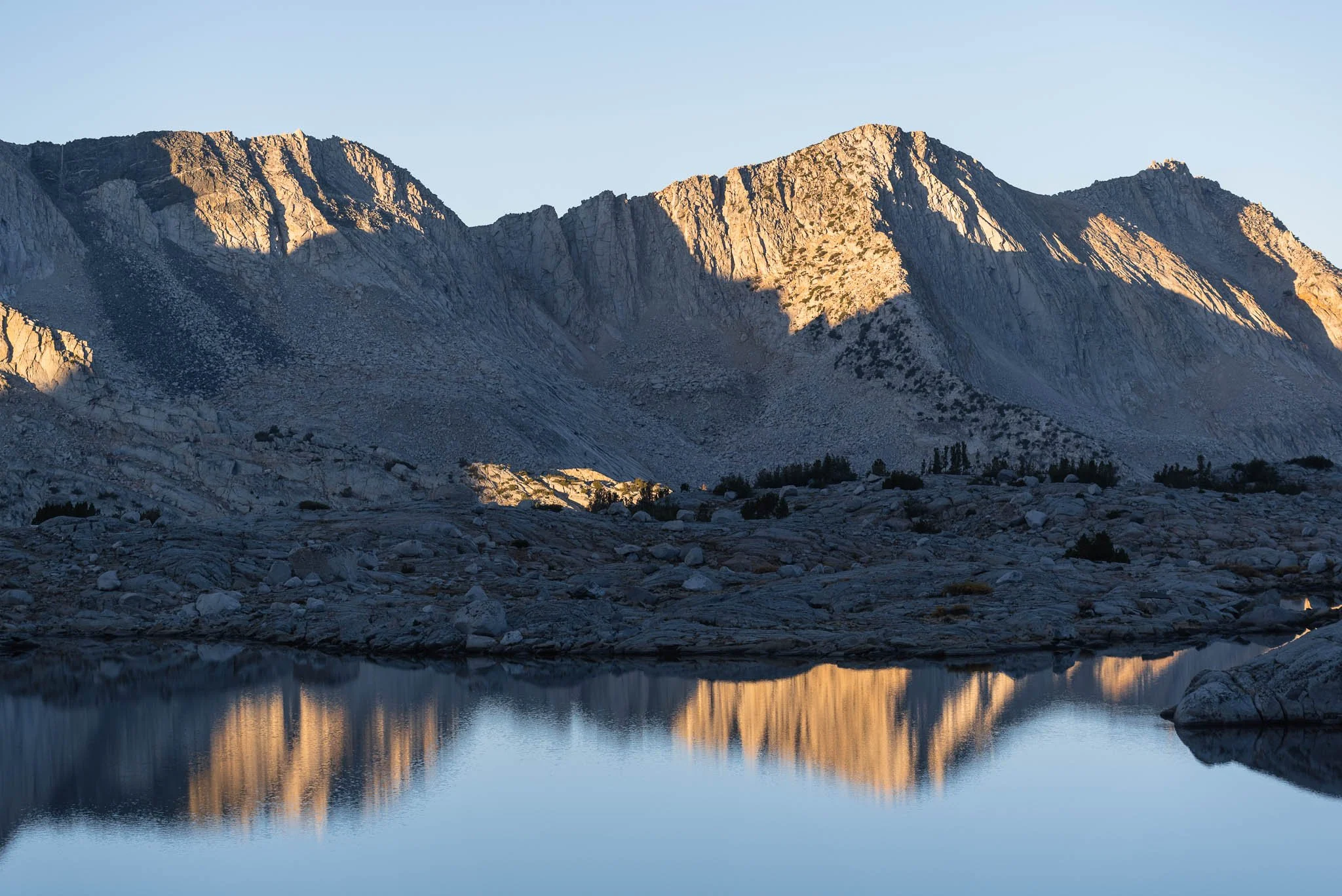
Bishop Lake as seen from Bishop Pass

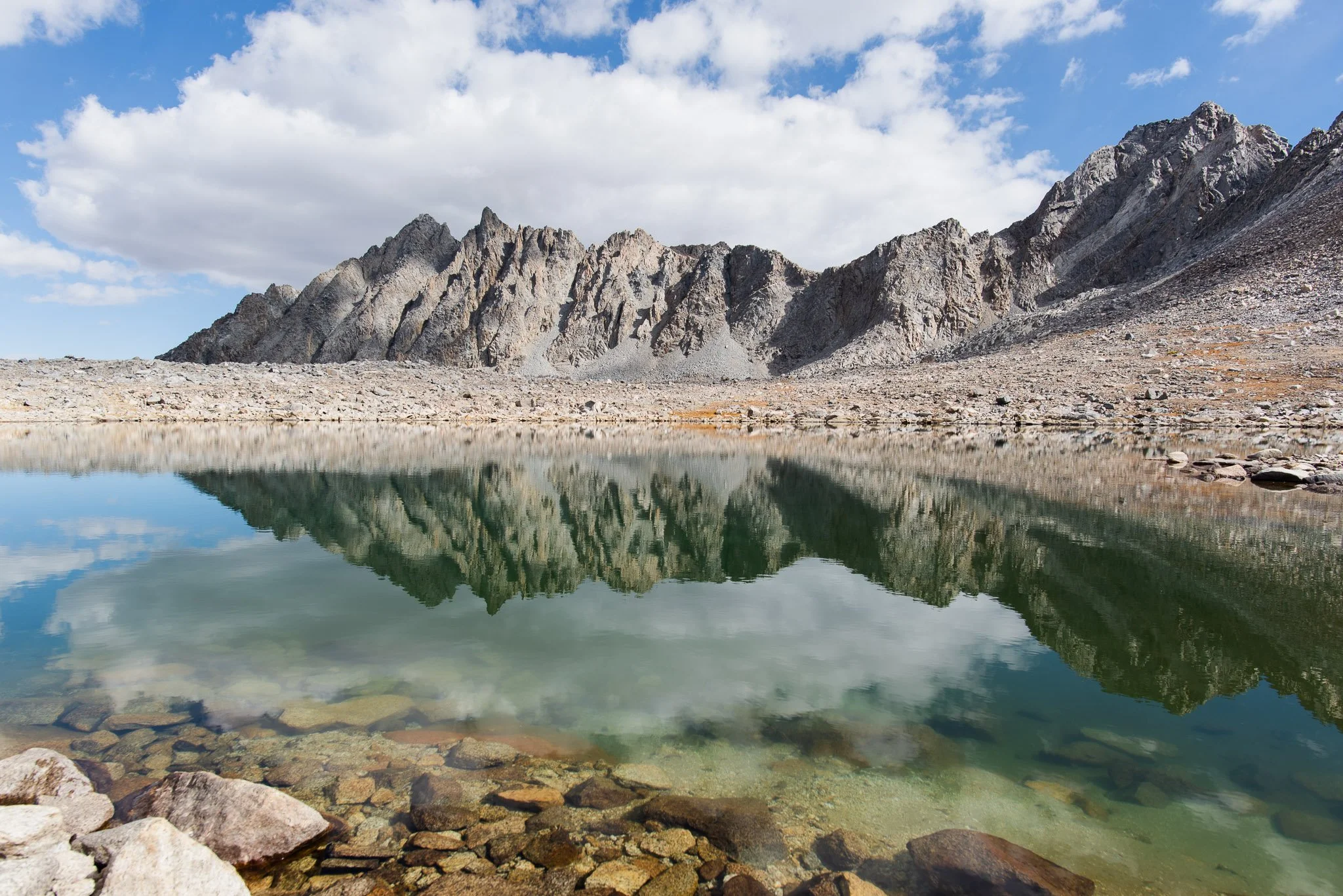
Timberline Tarn, which is fed by a stream from Saddlerock Lake on the opposite side of the trail
The trailhead was very busy when we got back. It's surprising to me that a mere 5 miles separated us from the bustle around South Lake and the pure solitude after Bishop Pass. Since it was our last chance to see fall colors this season, we made a few roadside photo stops on our way out to the highway before starting the long journey back to the Bay Area.
The more trips I do in the Eastern Sierra, the more I realize how vast this area is. When I type in the Bishop Pass trailhead on a map and start zooming out, I am mind-boggled by the number of alpine lakes and peaks. There are hundreds upon thousands of irregular blue shapes dotting the map, each with its own panorama of peaks surrounding it and often accessible only by off-trail travel. I try to identify geological landmarks when I write my trip reports, and with every one I write, I'm adding new places to my bucket list.
Alpine lakes galore, and so many peaks over 12k and 13k feet
I'm also often surprised by how close some of the names I know are to each other. Big Pine Lakes (still on my list!), a series of 7 lakes famed for their aquamarine color, sit just opposite of Dusy Basin across the Palisades Range. Granted, this doesn't mean it's feasible to hike between them, but in many instances, I do find ideas for off-trail routes just by staring at the map and Googling the names.
Despite the challenges of high altitude travel, I think about the way my heart soars when I'm exploring the outdoors, and I know I will be back. For the Eastern Sierra, even a lifetime is not enough.
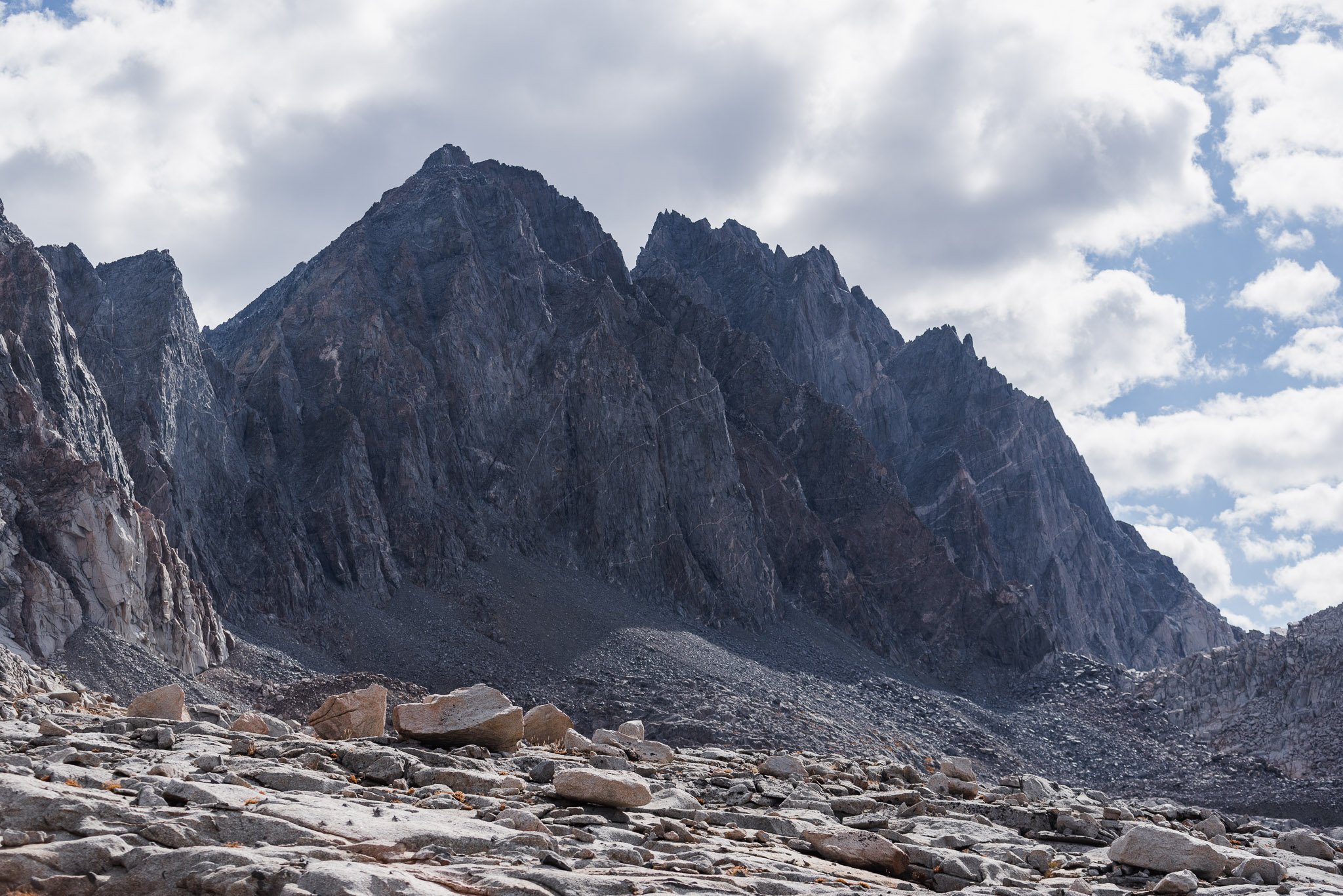
From left to right: Agassiz, Winchell, Thunderbolt pass